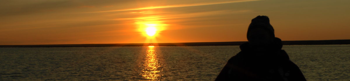
After our aborted attempt to go to the Northwest Passage back in August 2018 because our ship hit the rocks within 24 hours (the story can be found in our early posts on this website), we are leaving for Toronto this week to start our latest attempt, make the journey and tick that off our bucklist.
This time we are sailing with Quark Expeditions on its new ship, Ultramarine, which will be a massive upgrade from the old Russian cold war ships that were used by One Ocean in our 2018 attempt. We have travelled with Quark Expeditions before to Antarctica in 2012 and from Kangerlussuaq across the Davis Strait to the Hudson Bay in 2014, both voyages being fantastic memorable experiences. The voyage is entitled “Northwest Passage: In the footsteps of Franklin” and we board the ship in Kangerlussuaq, Greenland after a charter flight from Toronto.
Map of voyage as on the website of Quark Expeditions
The trip, like the 2018 one, is primarily historical and follows in the footsteps of the ill-fated voyage of Sir John Franklin which left Greenhithe, England in 1845 tasked with finding a way across the top of Canada, referred to as the “Northwest Passage”. Franklin and his men sailed in two ships, HMS Erebus and HMS Terror, and overwintered on the ice for two winters before they abandoned the ships. Franklin had already died by this time and the crew tried to hike back to the nearest civilisation via the Back River. All 129 perished hundreds of miles from the nearest civilisation.
We hope to see the graves of three of the Franklin crew who died in 1845/6 on Beechey Island as well as other artefacts left over 170 years ago. As you would imagine and even with climate change, the window for this trip is very short and there is normally only a couple of months a year when the ship can navigate this area, so expeditions are always subject to weather and ice conditions. This means that the route can change at a moment’s notice if the ship’s captain feels that safety is compromised.
In addition to the historical side of the trip, we will also visit remote Inuit communities and see the fantastic wildlife such as polar bears, walruses, whales and countless species of birds.
Some polar bears we saw in the Hudson Bay in 2014
Our posts on this trip will be more sporadic as we will be out of good wifi range for much of the trip but updates will follow when better communication allows. We look forward to you joining us on this very chilly trip.
Copyright: Words and photos John Cruse 2022 (apart from the Quark Expeditions route map above)
So there we were whizzing down a steep hill with sharp hairpin bends at exilerating speed in Sweet Pea, an arm each waving haplessly out of the window. Great excitement. It was just like an illustration in a children’s storybook. This was the life. A very different driving experience to Route 66 along which we had recently travelled. And then strangely everything stopped!
I woke up! We might be in the UK now but my sleeping head was obviously back with Sweet Pea this morning.
What a different type of holiday this was, made especially so by our historic cars; organiser and patient counsellor Neil; the calm and untiring Toncho, who I am sure worked in the dead of night as the cars were always spic and span the following morning; and our fun loving travelling companions Pauline, David, Suzanne and John.
But what of the Bulgaria experience? The food was always plentiful and we particularly liked the traditional Shopska salads with colours to reflect the national flag including cucumber, flavourful tomatoes (I had forgotten how tasty they can be), onions, olives, grated carrot, and a topping of tasty white cheese. I must try that recipe at home. Also moreish was the unusual crispy, but not fatty, cornflake-covered fried chicken pieces.
The people were friendly, although I soon realised that no ALWAYS means no. Don’t try to bargain. Flexibility does not seem to be a characteristic they enjoy. But I never got to grips with the head shaking and nodding which had the opposite meaning to our tradition. We found this in the more rural areas than the cities. The shaking of the head when ordering food was particularly odd. “Do you have cornflake-covered chicken legs,” got a shake of the head, but no alternative suggestion made, until I realised that the shake of the head was a ‘yes’. Mind you, if someone asked me if I had cornflake-covered chicken legs I think I would be a little surprised, if not offended.
And then there’s the driving. Well what can I say? I had my foot on the floor as if to action the brake downhill on many occasions even though I was not driving. Then there was the procedure. Fuel on, choke out and back in IMMEDIATELY commanded the Smooth Talking Neil. What about the gears? Ah reversed H set-up for this 2-stroke engine, and to get to first you MUST go into second first… or was that first second?
And NEVER forget lights on… it’s the law.
Some intrigued passers-by asked if we had air conditioning in this hot weather. We said yes, we just open the windows.
We learned a new hand jester: holding one’s hand out of the window and clenching and opening our fingers like a duck’s beak. What was the purpose of that? Well, to tell the Trabie driver behind that he still had his non-automatic indicators on. Strange thing that all females on the trip decided not to drive the Trabies… there must be a reason for that.
I shall also not forget my coordinates, especially when I go to the supermarket in future. These details, provided at least twice daily by STN took us precisely to our next port of call and not a short distance away as some maps can direct.
And how useful was WhatsApp (mobile data is all part of many UK packages in the EU) to alert our fellow travellers, not only that we had broken down (the car that is and not ourselves) but we could also send our coordinates to our rescue team – STN and Toncho.
I shall also not forget Sweet Pea’s wonky steering wheel, fitted quirkily at an angle, which managed to hide the blinking (interpret that how you wish) indicator light. But on the plus side John has built up his muscles like Rambo, having pulled the powerless steering wheel around the hairpin bends of Bulgaria for 600 kilometres (we’re metric in Bulgaria, but some 400 miles in English).
And we will surely not forget the laughs and jokes from our fellow travellers and STN; as well as our mechanic-on-call Toncho’s lower body sticking out from underneath our car on a daily basis.
So we say our fond farewells to such a different and memorable experience of a trip. Which leaves me thinking. Perhaps I should have tried out that reverse H gearbox, even for just one trip around the car park. Maybe on another occasion.
Trabants driving to Sofia video shooting and editing courtesy of fellow traveller, David Ward
Copyright: Words and photos Sue Barnard 2022
Note: If any viewers are not able to see the photos included in each post, just scroll down to, and copy, the URL link at the bottom of each email and use that to view the website online.
And here our tour draws to an end. Now with just two Trabies remaining we headed back to Sofia, some 100 miles and two hours drive to where we first started – a retail park near the airport.
Champagne Charlie heads into Sofia
We said our fond fairwells to Neil and Toncho, and our fellow passengers with discussions about a possible reunion around the Baltics with different vehicles.
Unfortunately, the new E10 petrol formulation does not suit classic cars such as the Trabants. To put it bluntly, it rots their guts. While some of its rubber parts can be replaced with current substitutes, the corrosion of its mechanical parts is a different story. Many of these are no longer available and it would be far too costly to have modern alternatives made.
Our wonderful fellow travellers, David, Pauline, John and Suzanne. Photo: Neil Penn
So sadly, this appears to be the final tour of the Trabies, and after waiting three years to join the trip due to the Covid restrictions, we were so lucky to be a part of it. We hope that the Trabants can be resurrected, but deep down in our hearts we think that is not likely.
Gone but not forgotten by our group and many others over the years who were able to experience the drive in these classic cars and the Bulgarian sites and sights they took us to. Our thanks to Neil and Toncho who made it happen just one more time.
Copyright: Words and photos (unless otherwise stated) Sue Barnard 2022
This was to be our final day of touring, and STN (Smooth Talking Neil) was taking no chances with us over-revving the engines when removing the Trabies from the underground car park. I don’t blame him. You should see the tight manoeuvres to reverse out of the parking space and the steep exit.
Sweet Pea was now fully recovered and we were heading to Plovdiv, in the boiling heat. We were wilting, but this time Sweet Pea was not.
For our first stop we headed to the spa town of Hisarya situated in central Bulgaria and ideally placed just 25 miles from Plovdiv. The town is one of the oldest and most popular balneological centres in Bulgaria…
Well that’s a term we don’t hear much of (if ever). Actually, before you rush to look up the word, as I know you will, it means the study of medicinal springs and the therapeutic effects of bathing in them. So there you have it.
Hisarya is famous for its healing mineral waters: 16 natural mineral springs and 6 drilled mineral water wells. Evidence of occupation dates back to the 5th century BC, and by the 4th and 3rd centuries BC those Thracians had moved into the region. But the settlement’s heyday was during the Roman era. In 293, Emperor Diocletian declared it a town and this marked the beginning of the construction of massive fortification walls, public buildings, baths and streets.
Ancient walls of Hisarya are still in use today
What makes this town particularly interesting is that the Roman ruins are blended into current day building. There is a central square with mineral water spring which was popular with the residents on this hot day, plus fountains and shaded cafes to relax in.
Central squareThe mineral springs were popular in the intense heat of the dayHoney is regularly on displays at markets and outside homes which have their own hives
Nearby was a small, but informative archaeological museum, whose staff were happy to stay open during their lunchtime so that we could make a quick visit. Inside there were artefacts from various digs and detailed information about a collection of giant crystals donated by a Bulgarian whose intention was to save them from destruction for others to admire their natural beauty. It is claimed to be one of two such collections of giant crystals in the world.
Marble onyx about 9 inches tallHuge geodes were displayed at some hotels showing the interior crystals. This one was about 3 feet wide
It was then time to move on to Plovdiv. But sadly when returning to our cars we faced some very sad news… the death of one of our group. We were all in mourning.
Blue Bayou’s last stand
It proved all too much for Blue Bayou. Perhaps it was the extreme heat of around 35 degrees, or perhaps she had just had enough. Slowly she was pushed onto the back of Toncho’s pick-up truck. The engine had given up. It seems that the new E10 petrol just does not suit these old classics. We are all hoping she will be resurrected, but this is not known at present. Maybe Fudge who never did Budge will give her a helping hand.
We headed to Plovdiv which is surrounded by the hills of southern Bulgaria. There are modern parts of the town, but several ancient sites based within the old town.
We managed to climb up the very steep cobbled roads in the intense heat to reach the Roman theatre of Philippopolis and the Forum. Much more could be done to provide visitor information at these sites and despite there being a lot of tourists in the town, the sites were almost empty.
Staging set for the evening’s opera performance
Today the Philippopolis, which once accommodated 6,000 people, is used as a venue for opera and concerts. It dates from the 1st century and is considered one of the world’s best preserved ancient Roman theatres, but is now covered in part by staging and chairs. The theatre is semi-circular in shape with steep marble seating. The site lay undiscovered for many years until the 1970s when a landslide led to archeologists excavating the area.
The Roman Forum that we visited was once a marketplace where merchants exchanged grain, wood and honey for pottery and bronze items. Today it is a shadow of its former self.
Oh as if we hadn’t been spoiled enough. STN (Smooth talking Neil) had arranged a very special day for us, travelling from Tryavna to Kazanlak to see some most interesting historical sites that larger vehicles could never reach.
Our focus today related to the Communist era, but before we made headway there was another surprise. Toncho had replaced our brake master cylinder and made a few tweaks, and all the hard work carried out while we relaxed and chatted over breakfast made a positive difference. Sweet Pea had got over her/his/its (we must keep on trend with these matters) troubles and was in fine fettle even on the most steep roads which had previously given gyp.
Our brake master cylinder hits the dust
We were heading up (and down) the many steep hills with hairpin bends aplenty. Sweet Pea had not minded the downhill parts (Neil insisted we gave the Trabies a break by keeping off the brakes downhill as much as possible) but until the latest mechanical changes, didn’t like the uphills. Well who does?
So on to our first stop, the Shipka Monument of Freedom. This tall tower was built to commemorate the fall of 500 years of Ottoman occupation in Bulgaria. At the Shipka peak 5,000 Russian soldiers and 2,500 Bulgarian volunteers (called Opalchentsi) fought and defeated an estimated 40,000 Ottoman troops in 1877. The liberation is celebrated on 3 March each year. The 32 metre tall tower today is a museum.
We then jumped into Neil’s wagon for our next memorable stop… and there was a reason. We were heading up, up and up an extremely pot-holed small road. It was difficult to drive a car along this journey, let alone a coach (or our Trabies). Hence, few groups reach here, although bikers like the challenge. We spoke to several who were enjoying it as part of their long-distance journeys across Europe.
The place we were heading for was Buzludzha, a Communist conference centre high up in the mountains. If this didn’t reflect power over the vast landscape, nothing would. The building was something out of the space age.
Two hands hold flames in front of the historic Communist building
Architect George Stoilov was approached in 1961 to produce a monument to mark 70 years since the founding of the Bulgarian Social Democratic Workers Party, later known as the Bulgarian Communist Party. His plans were not used at the time, but he was approached again some years later.
Stoilov made changes to his original plans, which were accepted. He was influenced by the Brutalist style of architecture and by Le Corbusier, amongst others. He wanted to produce a timeless monument, including ancient and futuristic concepts. The, currently dilapidated, monument is certainly impressive and must have been breath-taking in its heyday, if not because of the steep steps to reach it.
Today it is in a very poor state with graffiti, broken glass, and evidence of trophy hunters, but images of the original interior displayed outside the building show outstanding workmanship including many mosaics. Access is not possible. The architect would have been horrified to see it in this state. There is something about the building’s magnificence (whatever its history) that screams “save me”.
Much debate has been carried out about whether it should be demolished (because of what it stood for), or if it should be renovated because of its architectural significance. Without living its history, I am for the latter. It is such a magnificent building that why not turn it into something positive?
According to signs at the site, renovation is planned, sponsored by the Getty Foundation and ICOMOS (the International Council on Monuments and Sites) which works to save historic buildings of significance. Some people we spoke to still have their doubts as to whether work will ever go ahead, but this building is of such architectural importance alone I hope so.
Then, reunited with our Trabies, we headed down and down and down to Kazanlak at the foot of the Balkan mountain range, and within the Valley of the Roses. This town is at the centre of rose oil extraction in Bulgaria and, most unusually, it has a museum dedicated to the flower and rose oil production.
The museum is so unique John and I just had to visit. It is located in a circular building. Visitors perambulate around the ground floor where information boards and historic equipment are located, finishing with a walk around the central garden, of roses of course. Within the building there is a constant smell of rose oil.
Rose Museum
The displays provided information about roses and the oil from ancient times. Even Ovid, Vergil and Cicero are said to have praised the fragrance and beauty of the rose. Bulgaria, today, is one of the biggest producers of rose oil. Kazanlak lies within the Valley of the Roses, an area 95 miles long by 7 miles wide, south of the Balkan mountains.
The quality of rose oil depends on the combination of climate and soil, making Kazanlak particularly suitable. Just one kilogram of rose oil is produced from up to 3,500 petals of Rose Damascena.
And as if to complete our most enjoyable journey Sweet Pea was coming up roses having completed our first day with no hysterics. Sweet.
The historic town of Veliko Tarnova was an overnight base and we had an ideal position with our hotel rooms overlooking the extensive fortress of Tsarevets. We took the opportunity in the morning to hike up the rather steep site, a perfectly-placed location for the original occupants being more than 200 metres above sea level with vast views in all directions, allowing early detection of enemy attack.
View from our hotel of the fortress walls
Evidence of occupation dates back to the 2nd century BC, but from the 4th century AD onwards an extensive site was gradually developed. This included 3-metre high city walls with three gates and a drawbridge. More recent studies estimate the complex had 400 dwellings, 22 churches and four monasteries within those walls. The steep site is not for those delicate underfoot. Plenty of trip hazards here, but the views and gaining an appreciation of those who built, climbed up and lived within the site was worth it.
Then it was time to head onwards towards our next evening destination, Tryavna in central Bulgaria. We were beginning to realise that dear little Sweet Pea had a bit of an aversion to hills – whether steep or not so steep. She/he/it seems to be getting a bit precious in my mind.
As we struggled up a hill she/he/it was having none of it, and ground to a halt once again. We were heading for breakdown number three (not sure whether that was the car or us). Our guide and mechanic were soon on hand. I am getting the impression that we are becoming more familiar with the back ends of these two saviours rather than their top ends.
Rear ends, I’ll say no more
A slight adjustment to the new brakes which were expanding in the heat and still not bedded in, and we were on the road again.
Neil obviously had our karma in mind when he made an impromptu recommendation. Is there nothing this guy doesn’t think of? I told you he was smooth talking. “How about a bit of relaxation and lunch at a yoga retreat,” he suggested. “Done,” we all replied immediately and not soon after we landed on Rowena’s doorstep… well actually houses and barns.
The retreat was run by a British lady who had decided at a young age to buy a rundown property and renovate it. In fact, she now has a few buildings and barns in which she offers accommodation for those who want to retreat from the wider world for a while… or longer. Yoga sessions are offered several times daily. Some people choose the location as a ‘work-from-home’ alternative (familiarly known as ‘digital nomads’, I rather like that term), and can be seen working away on their laptops.
The retreat dining areaA time for relaxation, delving into books, or becoming a digital nomad
Having tucked into a healthy vegetarian lunch, one resident asked us if we would like to visit a dilapidated primary school, vacated in 1997. I jumped at the chance. Where else would you get an opportunity like this?
It is a sad fact that many small villages are becoming ghost towns. As the elderly pass away their offspring and others do not necessarily want to move in, there is little employment for them, and remember the population is in decline. This area around Gabrovo has faced the same situation, but the setting up of the yoga retreat has brought with it more occupants and a regular flow of visitors – all a benefit for the village.
The school today. A sad situation. How many young children would have climbed these stairs over the decades? But it is up for sale for DIY enthusiasts. Think of it as a projectEvidence of the last year of occupancyA few seats would have passed over this gym horse
Then we were on our way again, to Tryavna, a pretty town with cobbled streets, many independant shops and plenty of history – those Thracians made it to this area too. The architecture is very attractive, as is the pretty Kivgireniyat bridge at the town centre.
Beautiful architecture in Tryavna
A nice touch for locals and visitors was a plentiful photographic display in the town centre of people dressed in their traditional Bulgarian costumes and featured in their home towns with a recognisable view in the background. We are finding that the Bulgarian people are proud of their history and their traditions.
A town centre photographic display showing different traditional outfits and the areas they come from
And we’re off! We are getting to grips with the routine now. Fuel switch on, choke out, turn engine on and immediately (yes immediately as the smooth talking Neil stressed to us) put the choke in. Lights switch turned two clicks to the right (lights on is the law) and foot on accelerator. Rev the engine, handbrake off and we are on our way. The cloud of exhaust fumes from three Trabies is something that will stay with us… in our hair, on our clothes, but hey, it’s all part of the trip.
Ah, and don’t forget the indicator. Turn it on. And DON’T forget to turn it off – no automation here in these 1970s and 1980s East German beauties.
Today we are heading to a major and historic town of Veliko Tarnova, but before we do we shall visit the monastery nearby on the outskirts of Troyan. It is the third largest monastery in Bulgaria and its buildings are full of charm.
The setting was beautiful amidst a valley beside the river Cherni Osam. It was founded in 1600 and reconstructed from 1830. The site comprises several religious buildings and accommodation for the monks. For those who might want to get an insight into the life of monks there are bookable rooms for travellers. Surrounding the buildings is much greenery including grass, trees, firs and flowering plants – all rather idealic. The buildings are exquisite on the outside and many of the paintings within are outstanding.
We then headed for a lunch stop, but oh ho, Sweet Pea was having none of that, grinding to a halt outside a little cafe in a small village along the way. Great, an excuse for a coffee. Alas not, the cafe was closed for the full two hours we were outside… just to make moves to open as we drove off.
Once again mechanic Toncho and Neil did their stuff and got Sweet Pea on the road again. But our time was not wasted. Here we observed many A4-sized posters. These announced the passing of local people, and appeared on local public notice boards and on the outside of the individual’s home. They are also posted again on anniversaries of the departed. These public notice boards appeared not to display any other information apart from the departed.
John looks on as Toncho and Neil debate the solution
We headed on to the small town of Gostilitsa, known for its folklore events, many of which are recreated each year. This includes, on Grandma’s Day in March, women dressing as men and walking around the village until they come across a man who they will pick up (literally) and carry around in the air.
Our ice cream stop was a little more subdued – being a shop, formerly built by the Communists, but it was good to get a close-up of one of these buildings.
Our three Trabants on the left and Fudge who didn’t Budge sits graciously on the back of the trailer (right)
Then it was shake rattle ’n’ roll on to our next overnight destination along roads rather in need of resurfacing. We were on our way to Veliko Tărnovo.
Our first day with the Trabants started with an induction of the finer points of driving a 2-stroke old East German car. This involved how to change the gears, turn on the petrol, use the choke, turn on the lights, not over heat the engine and coast downhill in neutral with the engine off.
Then we were off to find the vehicles. Parking in the centre of Sofia is very limited, so our cars were at a retail park on the outskirts. We have four fellow travellers from the UK, Neil our tour guide, and Toncho our hard-working mechanic and, as we were to find out, always in demand.
At the retail park we were introduced to our vehicles fondly known as Sweet Pea (green), Champagne Charlie (well, champagne colour of course), Blue Bayou (who was to be the spare), and Fudge, who we immediately renamed Fudge who would not Budge – because it didn’t, and ended up on the back of Toncho’s truck for the remainder of the trip.
Champagne Charlie, Sweet Pea and Blue Bayou
All those willing had a hands-on attempt at firing up the little beauties and driving them around the retail car park before being unleashed onto the open road, a 2-hour stretch of dual carriageway heading north towards Balgarski Izvor for a meaty lunch.
Lesson one: how to drive a Trabant. Our guide, Neil (left) instructs
However, less than an hour on the road, Sweet Pea, our green Trabant. Came to a grinding halt (literally). The newly replaced brakes had seized and we crept onto the side of the road. But help is always at hand on this trip thanks to the wonders of our newly-formed WhatsApp group. A few clicks of the button and Neil was heading back down the road for us, and Toncho in his truck was not far away. Indeed, while we waited for these two saviours of the open road, a Bulgarian guy and his wife offered to tow us, which we were to find is typical of Bulgarian hospitality.
Sweet Pea breaks down for the first time
Toncho worked his wonders and our brakes, and us, had cooled down enough to head on our way. Ah for the open road, this time turning off to the countryside with mountain views in the distance.
Beautiful views of the Bulgarian mountains along the way
Hmmm, just when you think it is safe… Sweet Pea was having none of it. A rather sooty smell was occurring, and we found our brakes grinding to a halt again. We went through the same procedure: WhatsApp, Neil, Toncho, mechanical help, and back on the road.
We drove on several miles more to reach the small village of Balgarski Izvor and the rather large roadside restaurant where passing motorists and tradespeople ate, choosing from a grand selection of hot meats, bean soups, breads and salads all laid out in the open, almost market style, for customers to choose. We selected chicken fillets and tasty flatbread, and ate away while Toncho changed, what we found to be, a further issue of a flapping exhaust pipe. But we were to learn these incidents were just minor solvable issues in the hands of Toncho and Neil. All part of the experience.
A simple and tasty lunch at Balgarski IzvorAlways have a spare. A replacement exhaust pipe from Fudge that did not BudgeToncho replaces our exhaust pipe
Our destination was the Plaza Hotel in Troyan, which was once an hotel for the elite of the Communist Party. Troyan is named after the Roman Emperor Trajan. It was recognised as a town in 1868 and was initially an important craft centre for the region. Today it is famous for its pottery, and plum brandy (rakia). The population is around 18,500 in its centre. It is also the home of the historical site of the Troyan Monastery. We had travelled around 100 miles and had arrived pretty much unscathed.
There’s nothing quite like a tour of a city to get one’s orientation, so we kicked off our first day in Sofia, not via a Big Bus Tour this time as the town and roads are not big enough. Instead there is a much publicised free walking tour. Past experience has shown that the free tours are often not up to much, so our expectations were not over ambitious. However, this popular two hour tour was very good.
We were taken around all the main sites – outside, not inside as there would not be enough time. We started at the Palace of Justice which makes a good meeting point. It has a central positioning and two large lion statues outside which cannot be missed. The grand building was constructed between 1929-1940 with the purpose of having in one site all the courts of the capital, which previously had been widely spread. Today it is considered to be a ‘temple of justice’.
Lion outside the Palace of Justice, a favourite meeting point
We then headed past an archeological dig, unfortunately nobody was working on the site at the time. What we later discovered from a visit to the Sofia History Museum (housed within the thermal baths mentioned in an earlier post) was that this is just one of many archaeological digs in and around Sofia. As construction extends through the city with new gas pipes, Metro extensions and other major works, many ancient sites are being uncovered and with them discoveries of burials, building techniques, pottery, jewellery, and in some cases coin hoards. One wonders what they might discover in the future.
Ancient belt buckle. It would be attractive even today
There were churches aplenty on this walking tour including the very large Bulgarian Orthodox Alexander Nevski Cathedral. When it was completed in 1912 it was the tallest Orthodox Church in the Balkans at 53 metres high, but in 1984 the Serbian Cathedral of St Sava in Beograd surpassed it at more than 70 metres high.
Alexander Nevski Cathedral
The Sofia cathedral is capable of housing 5,000 people. Its belfry has 12 bells weighing 23 tons in total. We were told these were never rung at the same time as it would shatter the eardrums of many. The dark cathedral interior is heavily decorated with icons and sculpture, with works in Italian marble and Brazilian onyx.
Cathedral interior
Another church, Sveta Nedelya, had a tragic history. It had a bomb attack in 1925 during the funeral of General Konstantinos Georgiev who had been killed in an earlier communist attack. The church bombing was carried out by the Bulgarian Communist Party. Its intended target was Tsar Boris III. He survived but 150 people, mainly from the political and military elite, were killed and hundreds were injured.
A church with a tragic history
A further, rather attractive, church on the tour was the Rotunda St George built in the 4th century. It is considered to be the oldest building in Sofia and now belongs to the Bulgarian Orthodox Church. Three layers of frescoes have been discovered inside dating back to the 10th century. Today the building is dwarfed by the surrounding Communist-built offices (below).
The Ivan Vazov national theatre, another stop along our walkChanging of the guard at the President’s residence, a further site to see on the hour
Two other places our tour guide Milko recommended we take some time to visit were the Red Flat, and Sofia History Museum. We took his advice.
The Red Flat is an immersive ‘museum’. It is a one bedroom flat near the centre of Sofia which is set out as it would have been in Communist times. In fact it is quite hard to find. Tickets are purchased at a local shop, the shopkeeper instructing visitors to pass along a nearby street and ring a doorbell with a red sticker to gain access.
The flat interior was better furnished than one might expect. So many of the contents were familiar with our upbringing and that of our parents such as the Russian-made film camera, a chopper bike, photo albums with black and white images and a transistor radio.
The sitting room
What was surprising was the well-equipped kitchen with front-loading washing machine. I am sure many homes in the UK would not have had this luxury. To accompany our self-guided tour of the flat we had an audio recording of 48 ‘stops’ around the interior. It was suggested upon entry that we really did immerse ourselves in the experience, opening cupboards, sitting on the seats, reading the magazines. We didn’t take advantage by lying on the beds.
All mod cons in the kitchen
Within the well laid out Sofia History Museum with its labelling in Bulgarian and English was a temporary exhibition of 40 gardens in and around the capital. Such detail about gardens was most unusual for a museum anywhere in the world. It took each garden in turn via a poster display and listed its landscapes and designers, plantings, sources of some of its rarer plants, and showed architectural plans with some photographs of the resulting structures. Some of the gardens were large, others were green spaces within the city.
Something that also caught my eye was in a garden in the town centre where they had a display of the works of female architects in Bulgaria during the 20th and 21st centuries. This was pleasing to see and the displayed architects were numerous. Information highlighted the difficulties women faced in the profession and how some investors were reluctant to place projects with female architects. However, in time their skills, aesthetic views and achievements were recognised, and some were also appointed to high positions on architectural courses in universities.
So rather than not enough to do in Sofia as my initial thoughts, the walking tour and the visit to the museum proved there is lots to do in the capital to occupy days if not weeks.
Now the excitement begins. We have met our four fellow travellers and we leave in the morning for Troyan after having an initiation into driving the Trabies. But one thing to point out. My map shown in the prologue had our direction wrong. Instead of travelling anti-clockwise we are journeying clockwise. I had asked the smooth-talking Neil if he would change direction in order to make my map correct and not confuse my following friends, but it is not to be. So off to Troyan it is.
When we were booking this trip to Bulgaria, we thought we could go slightly further afield, on our non-Trabant driving days, and pop across the border into Serbia and visit the historic town of Nis, the birthplace of the Roman Emperor, Constantine the Great. Tripadvisor offered a day roundtrip which looked just the ticket.
The morning of the trip dawned and as we were having breakfast in our hotel in Sofia, the local travel agent called to say the trip was cancelled. The reason being that it was taking 2 to 3 hours to get across the border, each way. Apparently, there were a lot of Turkish travellers on the way home to Turkey for their holidays and they were using the crossing along with the usual lorry traffic. Daniel, the local travel agent, said that if we wanted, he was taking a small group to Skopje, Macedonia, that day and we could join this tour. So after 20 seconds of debate we agreed to go to Skojpe, the capital of what is now called The Republic of North Macedonia.
Before becoming an independent country in 1991, The Republic of North Macedonia has been under the influence of the Romans, Serbs, Bulgarians, Ottoman Empire and for much of the 20th Century was part of Yugoslavia. Hence, from independence it was called The former Yugoslav Republic of Macedonia until its name change in 2018 to North Macedonia to settle a dispute with Greece over appropriation of symbols and figures that Greece considers Greek culture such as the Vergina Sun (on the old Macedonian flag) and Alexander the Great.
The old (left) and new (right) flags of Macedonia
It was a good 4 hour drive to Skopje from Sofia and we crossed the border with the formalities taking about 10 minutes each way. In Skojpe we met our local guide who would show us around the town for a couple of hours. Skopje had a devastating earthquake in July 1963 that had reshaped the development of the town so the area around the River Vardar has been rebulit with many impressive buildings and statues of the likes of Alexander the Great. Some of the new riverside buildings were being used by Government departments and commercial businesses.
One of the parts of Skojpe that had not been devastated by the earthquake and cleared for rebuilding was the Old Souk area which contained many small shops selling all types of essentials for the locals, with some tourist shops for those things you never knew you needed. Mixed amongst the shops were some old bath houses (some were now used as museums) and caravanserai dating back to 15th century. A caravanserai is a travellers inn where the animals were put on the ground level overnight and the riders housed on the first floor. They were located a day’s ride from each other to not over-tax the animals, so roughly 30 miles apart along the trade route.
The CarvanseriInside the CarvanseriThe Bathhouse now a museuum
Probably the most famous resident of Skopje was Mother Teresa of Calcutta, now Saint Teresa of Calcutta. She was born in Skopje to Albanian parents in 1910 and after 18 years in Skopje she moved to Ireland and then to India where she spent most of the rest of her life until she died in 1997 at the age of 87. A museum dedicated to her life is in the centre of Skopje and it displays the Nobel Peace Prize certificate.
The final stop on our day trip to Macedonia was to visit the Matka Canyon where the Treska River has been dammed and the Matka Lake formed above it. The drive up the mountain to the dam was very tight and not for the nervous motorist. There are some interested Vreio caves that can be visited by a short boat ride from the dam and it is a very popular destination for locals on their days off. We were told that there are also some underwater caves that possibly could be the deepest in the world, although this has not been confirmed.
After the boat trip and caves we drove the 4 hours back to Sofia arriving at 10 pm. A long day but worth the trip.