If you like the written word Tahiti could be the place to be. Writers have certainly made the words flow here, whether it be fiction, non-fiction or poetry. I didn’t know what to expect in Tahiti, but our foray into the South Pacific island, part of the Society Islands, involved visits to the homes of two prolific writers of the past.
These were James Norman Hall, an American writer who spent most of his life in Tahiti; and Robert Keable, a missionary turned wordsmith.
The James Norman Hall house and museum
Hall’s home is now a museum and is very much as he left it (apart from the roof solar panels). Shelves ooze with books of all sorts, divided into subjects as far ranging as children’s fiction to history. There are even copies of William Bligh’s log of HMS Bounty. You would have to be keen to read this tome of hundreds of pages, the writing is really hard to decipher but I am told Bligh was most detailed in his daily reports of the voyages.
A little bedtime reading
Hall was a prolific writer and is probably best known for his work with Charles Nordhoff, The Bounty Trilogy: Mutiny on the Bounty, Men against the sea, and Pitcairn’s island, published in the 1930s and subsequently made into films.
One of Hall’s books, Doctor Dogbody’s leg, had a sudden flush of interest a few years ago, which took the museum by surprise. When asked which book would you take with you to a desert island on the long-running UK radio programme ‘Desert Island Discs’, Keith Richards of Rolling Stones fame said: “Doctor Dogbody’s leg”. It certainly raised interest in author Hall and his works.
We were most fortunate to have a private visit of Robert Keable’s past home. He too was a prolific writer. He was once a missionary and priest, then turned his back on the ministry following what he witnessed in World War One. He later caused a scandal with his 1921 book ‘Simon called Peter’ about a priest’s affair during the war, with a young nurse. But there is nothing like controversy to sell books. This one sold 600,000 copies in the 1920s alone.
Keable’s life was full of upset. He left his wife for a young lady, Jolie Buck. They found an idyllic place to live in Tahiti overlooking the sea. She drew up designs for their new home. But then Jolie became pregnant and they returned to England hoping for a safe birth. Sadly Jolie died in childbirth at just 25 years old. Their premature son was not expected to live and considered too frail to travel. Keable returned to Tahiti and the house was built to Jolie’s specification. Sadly Keable died there just a few years later of kidney disease. He was 40 years old.
The house still stands without any changes. It is the most beautiful home overlooking the ocean, and has many beautiful plants that he introduced including tall, thick, red bamboo.
A one-time neighbour was Paul Gauguin, famed for his paintings of Polynesian women. Unfortunately, the Gauguin museum is currently closed.
Gauguin’s home was on the peninsula in the centre of this image
Our visit to these two homes was part of a 72 mile trip around the island. The road, of which there is only one, does not quite encircle Tahiti as the south-easterly tip has proved too difficult to engineer.
One of the many beautiful views along our journeyFishing boats after their early morning catches
The island is, of course, famed for its breadfruit. Captain Bligh was sent to Tahiti to collect this for transportation to the West Indies to feed the slaves. Breadfruit is still today a staple of the island and used in the same way as potatoes. Varieties can vary from sweet to not so flavoursome, so it pays to know what to look out for. Unfortunately, we did not get a chance to taste and compare, but these are early days.
Walking around Papeete (the capital) itself highlighted some interesting aspects. The parks were extremely busy, especially with the young playing one of their favourite sports, volleyball.
The parks and sports are popular in Tahiti
This was around 3pm. The day starts (and ends) early in Tahiti, due particularly to the huge traffic jams during rush hour. Public transport comprises the rarely seen buses (we didn’t see any). Therefore, people who live away from the capital start out, sometimes around 4am, to get their children to school on time. While there are primary schools in some villages (education is compulsory from 3 years of age), the secondary schools are in the capital and that can involve a long, slow, journey. As our guide told us, family time is often during those long drives each day.
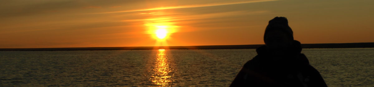
Ted enjoys the view from his hotel balcony, dressed in his Hawaiian shirt (or should that be Tahitian?)
We came away from Tahiti with much more than expected, especially viewing the two beautiful homes of the writers, but also with a booklist that will take us the whole of next year to complete.
Our route from Tahiti to Valparaiso (courtsey of Silversea Cruises)
Our final trip of 2022 is fast approaching. Yet another trip booked pre-Covid and shelved for a couple of years. As can be seen from the route map above, it is an exploration cruise from Tahiti, French Polynesia across to Valparaiso, Chile, visiting the many islands that are situated inbetween. Our friends in Australia, Eric and Diane, alerted us to this trip and we could not miss the opportunity to visit such a remote British Overseas Territory, the Pitcairn Islands, which were the main thrust of our interest in this trip.
I am sure that many of you will have read the books and seen the films about the Mutiny on the Bounty which happened in 1789. The reason I mention this is because some of the mutineers and some Polynesian men and women hid on the Pitcairn Islands (Adamstown) and remained undiscovered from 1790 until 1808.
For those unaware of the story of the mutiny on the HMS Bounty, it was captained by Lieutenant William Bligh and was engaged in transporting breadfruit from Tahiti to the British colonies in the West Indies. The expedition, which left England in October 1787, was promoted by the Royal Society and its president Joseph Banks who believed that bread fruit would grow in the West Indies and be a cheap food for the slaves in the sugar plantations. After sailing around Cape Horn and into the South Pacific Ocean, the mission was to pick up bread fruit in Tahiti and take it to the West Indies via the Indian and South Atlantic Oceans.
The crew consisted of 46 men, 44 Royal Navy seamen and two civilian botanists. This included a 23 year old Fletcher Christian, Master’s mate, who came from a wealthy Cumberland family descended from Isle of Man gentry. He had twice voyaged with Bligh to the West Indies and served on the Bounty without pay as one of the “young gentlemen”.
Bligh enforced strict discipline on the ship and when men stepped out of line, punishment was dealt out. There were clashes between Bligh and his officers on the trip down to Tahiti so when they reached Tahiti, the 5 months stay to collect bread fruit must have been a relief for Captain and crew. It seems that many men were not happy to leave the attractions of Tahiti, particularly the promiscious women, as they had enjoyed their time there. It seems that Fletcher Christian’s mood was not generally good and it did not help when, back at sea, Bligh accused him of stealing coconut from Bligh’s personal supply.
A mutiny ensued on 28 April 1789 and Bligh and some of his loyalists were cast off in the ship’s largest open boat. Bligh and his loyalists finally made it back to England in March 1790. The mutineers returned to Tahiti and some stayed there but Fletcher Christian and 8 others mutineers, along with 20 Polynesians (6 men and 14 women) left finally arriving in the Pitcairn Islands.
There is a lot more to the Mutiny on the Bounty, a true story, which is well worth reading as the above is only a very short precis. I would not suggest watching a Hollywood film on the Mutiny as Hollywood tends not to let the truth get in the way of a good storyline.
The above story tweaked our interest in this trip but I am sure there will be much else to report on as we visit French Polynesian and the Chilean Islands on our way across to Valparasio. We have visited Easter Island before so it will be interesting to go back and see what may have changed in the last 22 years.
For our final few days we took a flight west to the Bayan-Ulgii province to see the Eagle Festival. Our first night was spent with eagle hunter Aiu and his family. After all the entertainment and ankle bones games of the night before, Aiu invited us to see his eagle in action. He had won many awards at previous Eagle Festivals, but due to family commitments would not be attending the two-day event. However, he was keen to show us up close the skills involved in this highly-respected Mongolian tradition.
Aiu sets off with his eagle
We watched Aiu set off on horseback with his 10 kilo bird resting on his outstretched arm. Once we arrived at the mountainside his son took the eagle up the mountain. When there, Aio tied some (deceased) prey onto a rope to attract the bird back.
Then, calling out with a sound only his bird would recognise, the eagle came flying down from the mountain top to catch the prey. Aiu stayed on horseback throughout. It all happened so quickly and efficiently. Keep in mind that when not performing the bird would be used for hunting small animals and foxes, all of which is carried out for the family’s use with nothing wasted, and is not hunting for sport.
Aio explained that just one female chick is taken from a nest, and is trained by the hunter who will keep the bird for six years. At that time, it will be released into the wild so that it can breed. The hunter then attempts to find his next chick. Most hunters are male, but there has been a film made of a very successful female hunter, although she is a rarity.
The bird was flown from the mountain top on several occasions for us to get a close-up.
It was then time to leave our host and travel to the festival site at Sagsai. Here we would sleep and eat in gers for the next three nights. This, in itself, proved another interesting experience. The evening would end right after supper had been eaten within a communal ger, simply because it was dark! There were no lights at all outside so with a head torch we would make our way back to our ger, up and down the undulating ground, which was well trodden by cattle, who left their mark everywhere!
A fire in each ger was welcoming (well mostly, more of that in a minute), but the fire would burn out in an hour or two. Hence, the night was freezing, and all you could see of me was my nose poking out of the blankets. I wish I had a photo of that. Our guide would come in at 7am to relight the fire so we could start to defrost about 30 minutes later. The water for washing was freezing, literally. Even the liquid soap was frozen!
But what was that about the somewhat unwelcoming fire? On our first night our guide came into the ger to talk with us. I heard a swishing noise outside and asked what that was. “It’s probably some maintenance,” she replied. That was puzzling as it was 9pm and pitch black outside. I suggested we might take a look.
As we walked outside we found out what the swishing sound was. Some of the drivers were throwing water over our roof. The embers from the chimney had fallen down on the plastic and felt roof and caught alight.
Our forlorn ger roof
We had been totally unaware of the fire – there was not a sound – and it was only by chance that it was found. A driver had been walking behind our ger, possibly to get firewood, and noticed it. The fire was at the rear of the ger where nobody would have need to walk, so we were most fortunate. Thankfully, we lived to see another day, and this was full of entertainment.
Moving the ger by camel
First up was a demonstration of the dismantling of a ger and the packing up of its contents, which were then taken by camel to the festival site. There, the ger was rebuilt. There is a special procedure for this, and it became apparent having watched an interactive demonstration a few days previously at a museum.
The ger takes shape with the roof struts being added
The rebuilding starts with the lattice walls being erected in a circle and the pre-made door added. Then the centrepiece of the ger roof is hoisted into place. This is a wheel with wooden spokes, to which wooden roof struts are attached. Fabric roofing and walls are added to the outside, before women decorate the inside. This whole procedure takes about two hours to take down for the experienced (two days for the inexperienced!) and a couple of hours to rebuild.
Once we arrived at the festival, nearby, we found there was a whole host of activities. This is serious stuff, winners receive prestigious awards. As we saw at the home of Aiu, his awards are proudly displayed on the walls.
The hunters arrive
First up was some eagle hunting, the fastest result is the winner. We watched in anticipation as, one by one, each eagle was taken up the mountain while his trainer, on horseback, waited on the flat ground nearby to us.
The hunter was ready, the eagle was ready, the audience was ready. The hunter made his call. It was mighty windy. The eagle was released. We watched intently as it rose to the sky. And it rose some more, and some more, circling high above us.
Unfortunately, there it stayed. That strong wind was making it difficult for the eagle to hear the call. Deflated, we waited. Just how do you get an eagle down from way up in the clouds? We were not to find out anytime soon.
Eagle hunter number two arrived. The procedure began again. Up the mountain side the eagle was taken. All set, the eagle hunter made his call. The eagle set off. It rose into the sky. And rose again. Instead of heading to the eagle hunter, it headed to the first eagle on the loose. Both circled way above us, as if to take the mickey.
By this stage we were in fits of laughter. It brought back memories. We have an annual community event at a local park nearby us. We attended this year to watch the dog show, an event for residents’ dogs. Not one did as it was told – don’t work with animals and children comes to mind. The start of this eagle hunting competition seemed to be just the same.
A few other birds did fly to their hunters successfully but, because of the wind (oh, and a third lost bird) it was decided to postpone further flights until the following day.
A successful hunter with bird in flight
Other events followed with riders having to pick up a small cone from the ground while riding at great speed on their horses. Not falling off their horses while doing this is quite an art.
On the second day the eagle flights were resumed which had 100% success as the wind had dropped. This was no consolation for the hunters whose birds had flown – keep in mind that it takes years to train the animals, and this was the first time they had flown since the outbreak of Covid.
But there were more interesting events to come. One included couples racing across the land together. The fastest couple won the event. However, there was an added twist. Each woman held a rope or stick with which she would beat her ‘husband’. Well the women seemed to enjoy it and the men were willing participants, as a win could earn them yet another award. The audience enjoyed the speed with which it was acted too.
Some competitors seemed to get a little too much enjoyment from this event
But what about that ‘Tug of wot’ I have mentioned? This was actually called the Tug of War, but I think the title was ill-conceived. This actually involved a goat (dead I would add), and headless. Two riders on horseback would lift the hefty beast and attempt to pull it from the competitor while on the fast-moving horse. Some attempts were short-lived, but others went on for up to 10 minutes. At times, the uncontrolled horses (the riders were intent on grappling with the goat) would head straight towards the onlookers. On several occasions, with the fighting pair in my lens sight, I thought I was getting a really good photo, only to realise they were coming straight for me! Actually, I did get some very good photos, but looking at them I feel they are rather too graphic to include on this occasion.
All of this could seem quite shocking for some, but it is tradition and is carried out in a competitive way with skills developed from one year to the next. What was really touching was that the older, more experienced, hunters, apparently let a far younger hunter win the tug of war. This, we were told, was to encourage other young potential hunters to compete in future years. Without the newcomers, yet another tradition will be lost.
Proud winners display their awards
And there was more good news, at least for one eagle hunter. On the second day of the festival he returned to the site to look for his lost eagle. The eagle had landed. It was perched on the mountainside. Alas, the other two eagles had done a runner.
The following day we made our way back to Ulaanbaatar for our journey home, with great memories. Living with and interacting with the nomadic people gave us an insight into a culture we would not have achieved had we not travelled Mongolia in this way. The nomadic people appeared happy with their lives, although recognising that the young may not necessarily follow in their footsteps. One wonders, with all the trappings of the Western world, who is most happy with their ‘lot’.
Mongolia, a beautiful country with most hospitable and friendly people
Ever played ankle bones? It’s very popular in most households in Mongolia, and might not be what you think. But more about that later.
Despite all our off-road travelling, eating and sleeping there was so much else to do, and looking back I don’t know how we fitted it all in. Our trip really was non-stop from morning to night.
We were in for a great treat on one of our days, when we were fortunate to witness a ger warming, which coincided with the owners’ 25 year wedding anniversary.
If there was ever a ‘right time, right place’ experience this was it. Our driver Tugsuu had 10 siblings, one of whom (a brother) was carrying out the celebrations. Our group (John and I, our new travelling companion Carolyn from the US, our guide Migo and Tugsuu) just happened to be in an area of the vast Gobi Desert when this ger celebration was being carried out and because of Tugsuu we were all invited to the happy occasion.
We learned that when a new ger is purchased it is tradition to ‘christen’ it by inviting friends and family along who bring gifts, such as alcohol, food or cash. These are presented along with blue silky sashes (we purchased ours from a local store). The sashes are also often seen at temples as part of worshippers’ offerings.
When we arrived the party was in full swing and we were made really welcome. Once seated among the guests we were invited to get involved with the customary sharing of snuff bottles with our host, each of us in turn.
There were at least 30 guests squeezed into the new ger, along with masses of food. So many of the guests were dressed in brightly-coloured deels and they lined up to present their gifts.
John presents our gift, with traditional blue sash, to our hospitable host
To illustrate the significance of the occasion some of the guests presented whole cooked sheep carcasses, each with their heads on top. I saw three, and there could have been more delivered throughout the day. This amount would be rare. Dishes of soup, breads, curds, vegetables, lamb, horse meat, salami and chicken were all elegantly displayed, along with the very expensive fruit, including apples, grapes and bananas.
Hard, sweet, curd is even presented in decorative forms rather like a cake
Soup was our first course, then came the meats, pickles and vegetables. I tried the horse meat out of curiosity and politeness. I have to say it was particularly tender and flavoursome. It was not long before the vodka came out and was shared in a dish amongst guests, with gay abandon. Right from the start we were not looked upon as strangers, but accepted as the hosts’ guests, which was most welcoming.
There was also entertainment, and this was wonderful. I have referred to the throat singing we experienced earlier this year amongst the Inuit women who demonstrate a deep tone, in a playful, competitive way. In Mongolia this is quite different and something we had not heard before. It is the men who throat sing and use their voice in a much higher pitched way, as if it is an instrument.
Mongolian throat singing can be beautiful and joyous to hear and we were so lucky that our hosts had a professional throat singer to entertain us. The male singers study for many years to achieve their status as a professional throat singer.
We were privileged to have a professional throat singer at the party – a reflection of how the ger celebration is held in high esteem
When we left, our hosts and many family members came outside the ger to wave us off, having first enjoyed some photo opportunities.
Throughout our journey we were to find that singing is something many families do. If you are lucky, as we were at times, one person may just break into song with others joining in, often playing instruments. One evening when we were having our supper, an eight year old boy picked up a dombra (a long-necked lute) and started playing and singing, which was brave of the youngster especially being amongst strangers. Then other Mongolian people joined in. This is a tradition to be savoured, especially when it could be so easily lost with television and social media now being on tap 24 hours a day.
When not being entertained we tried our hands at a few other activities including kayaking, something John and I had not done before. The water was fairly shallow and freezing cold and in one area we had to get out and push, but I was determined to beat John to the finish line… I succeeded!
A camel ride too was in the offing. I wasn’t looking forward to that, and crikey it was a long way down. These were Bactrian camels, with two humps and some can be 8 feet tall. The benefit was that I could keep a firm hold on one of the humps as we meandered across the desert.
I was quite pleased when we got off (not looking forward to the time the camel would drop to its knees with us humans being tipped forward and then jolted back without any resistance). As soon as we got off we sauntered away rather like John Wayne, tipping from side to side – the camels were so wide. We were still aching from the uncomfortable seating arrangements after several days.
Another new experience was archery, which was a scream. So many times I tried to let the arrow go whizzing to a nearby target. Each time the arrow flopped to my feet, with no danger of me being speared. Gosh, those bows are hard to operate. One needs arms of steel, but once I got the hang of it, it proved to be rather addictive, and a source of so many laughs.
In a small area of the Gobi Desert we carried out tree planting – well Tugsuu did all the hard digging. This project was a worthy cause. The initiator, a lady named Byamba, purchased an area of land 40 years ago with the aim of trying to fight against desertification. This is where land degrades to such an extent in arid and semi-arid areas that it cannot sustain plant growth. It can be caused by a number of things including lack of rain, climate, grazing, and human activity such as felling trees. This latter point is a long term issue across parts of Mongolia. Gers are heated with wood, and forests can be seen across the country which have had swaths of pine trees cut down for this purpose.
Without plants, humans cannot feed off the land and animals cannot forage. Without trees, winds are also a problem.
In an attempt to redress this, even in a slow small way, Byamba has been growing native trees – the saxaul – from seeds and cuttings in greenhouses at her home. Then, working on her own or with small-scale help, she has been planting these slow-growing trees in the sandy dry land. In so doing, she is attempting to offset CO2 emissions and reduce greenhouse gases; reduce wind and dust (the tree roots help hold the soil together, thus reducing soil erosion); provide wildlife habitats; and preserve native Gobi trees.
This long, slow, project is paying off as birds are seen flocking to the treesEven Ted helped with the planting
During our time at the site we planted and watered in a few trees, and admired the work Byamba was doing, which is a hard task. Some of the trees planted in 1999 are still only eight feet tall. Another we saw, planted three years ago, was three feet tall. In more hospitable landscapes the saxaul tree can grow to 26 or more feet.
Then, having done a tiny bit to help with these matters, we were on our way again. A lot of hiking was involved on this holiday including so many climbs up to monasteries – they were usually locked or in a ruined condition once we got there. The vast majority of religious buildings were desecrated during the Communist regime, generally in the 1930s. At some, that did not involve a hike, we were able to view the monks carrying out their morning chanting. This was popular with local worshippers. Their sounds were rather soporific as we sat and watched, but seeing some of the monks on their mobiles, or being served their breakfast supply of mares’ milk during the chanting came as a bit of a surprise.
Of great historic significance in Mongolia was a discovery in 1923 at the Flaming Cliffs in the Gobi Desert. Fossils of 15 dinosaur nests containing 50 eggs were found which led to the understanding that dinosaurs were not solitary animals but they established colonies. These were originally thought to be nests of the Protoceratops. However, expeditions in the 1990s found further identical eggs, one containing an embryo identified as an Oviraptor.
Mongolia also has many petroglyphs, some considered to date back to 11,000BC. The images produced over the centuries illustrate the transition from hunter gatherers to herding and on to a horse-dependant nomadic lifestyle. They are so valuable for the insight they give to pre-historic ways that they are protected by UNESCO. While it is brilliant to see them in their original sites, they are open to the elements and graffiti addicts. It is surprising they are not better protected in some way.
But they are not easy to reach – they are sited high up steep, craggy mountains. Climbing the mountains was really hard going, but there was something that I had not expected on the way up. A Mongolian man offered his arm to help me up the mountainside – at a rate of knots I might add. It became more of a run than a climb! As we were heading up the sharp incline the gentleman asked to marry me. I was a bit perplexed and thought a while, saying: “Maybe that is possible, but you’ll have to ask my husband first.”
“But I don’t want to marry your husband,” he exclaimed. Hmmm, that was not what I was getting at. I then enquired: “Are you rich?” He rebuffed my question, saying: “You’ve got to be joking. I’m a tour guide!”
With that, and having a good idea of my answer, he dropped his arm and left me to climb the remaining craggy rocks on my own. Blast – I should have spun that out until we got to the top!
But there was another experience that will remain memorable. It was the ankle bones. Our eagle hunter host Aiu had two young sons who looked so excited to interact with us during our overnight stay, despite the language differences. I found just the opportunity when they showed me a bucket of ankle bones. Yes, this was indeed what was in a bucket they presented me with – hundreds of sheep ankle bones.
Ankle bone table mat
These are displayed throughout Mongolia in homes, restaurants and shops, whether they are used for games, decoration, table mats or jewellery. Most are in their natural cream colour, but some are painted. They can be played in a similar fashion to ‘five stones’ which we enjoyed as children.
Many games involve scoring against other players and this is what we did. We each threw four bones at a time, and according to the way they fell we scored points. Each of the four sides of the ankle bone has a different shape (one needs a keen eye to see that), and points were awarded for pairs, a full house, and so on.
A round of ankle bones
The two young sons, their eagle hunter father and I all played. I tried my hardest, but the odds were against me. Each time I came last until father did some trickery and I managed to come second to last. He was the perfect host and we all laughed throughout.
There was never a dull moment in Mongolia, and we had so many new experiences. But there was one further experience to come, to be covered in the next posting.
I put my nose against the small offering bowl a shop owner had presented to me. The contents comprised a white liquid. I sniffed. I didn’t recognise the smell but it didn’t smell good.
The unusual cold offering
I was inquisitive. I sniffed again. It was at this stage I took my first sip of the cold liquid. It was definitely horse. How did I know that? I had never, knowingly, tasted anything horsey. I sipped again. This time I had a lemon fizz sensation. I sipped a few more times. The liquid was like a very light milk, with little fat and this was exactly what it was… only this was mare’s milk!
I had never given it a moment’s thought that horses could be milked, let alone have a desire to drink the produce. This was my first experience of drinking mare’s milk and surprisingly I willingly continued until the whole cup was consumed, which was much to the amazement of my travelling companions. That lemon fizz sensation turned out to be a small alcohol content caused by the fermentation process.
A visit to most nomad gers will show fermented mare’s milk in the making. At some sites, if the time is right (June-September), a visitor may be able to see the milking process being carried out. This we saw at Arkhangai, near the centre of Mongolia and on the northern slopes of the Khangai mountains, where we were lunchtime guests of a family.
Our hostess Naraa milks the mare as our driver Tugsuu holds her foal close by
It was a privilege to be invited to see the mare milking. Our guide had dropped in to a small collection of gers along our route. Travelling groups, presumably of a small size such as our own, had arrangements to call in to families if in the locality to see if they could provide lunch. That gives income to the families and helps the tour companies, as cafes are sparsely located outside the capital. It can also add so much to the enjoyment and education of the tourist.
In addition to a wholesome lunch of homemade noodles combined with meat and vegetables within a soup, we got an insight into the milking and fermentation process. Our hostess, Naraa, was clearly a busy lady. While her husband was away herding, in addition to the usual ‘housewifely’ duties, she was, at this time of year, milking the mares and processing the milk. Naraa was happy for us to look on, and was aided by our driver Tugsuu who had spent a lifetime working with horses as part of his growing up.
Not wishing to miss this experience, we rushed outside the ger to the waiting horses. Each foal is tethered along a rope, and then brought to their mothers one by one. The foal suckles and is then removed to its mother’s side. This starts the milk flowing and the hand milking follows. This is carried out every couple of hours for one to two days when the mother and foal return to pasture for a few more days, and the process begins again. The quantity of mare’s milk production is less than that of a cow.
The milk can be consumed ‘raw’, but fermenting extends its life. Fermented mare’s milk, known as airag, is produced on a small scale by pouring it into a cowhide sack, called an arhad, and adding yogurt as a starter culture. Over the following days the contents are churned thousands of times to aid an even fermentation process.
The cowhide sack used when fermenting mare’s milk. The contents are stirred thousands of times
The mare’s milk is also used to produce butter (often combined with raisins), or a sweet, hard, curd eaten in a similar way to confectionery. Excess milk may be frozen or sold to local stores.
Freshly fermented mare’s milk can be purchased by the bottle in some stores
Mare’s milk curd. It can also be served in blocks. The longer it is cooked the darker and more intense the flavour – almost like very hard toffee
Research has shown that mare’s milk has many benefits, including low fat, and is a good source of nutrients. The biggest thing westerners need to overcome is the acquired taste.
Another acquired taste is the high level of mutton served in dishes for breakfast, lunch and dinner. At breakfast this could be a simple clear soup with lamb pieces and a few vegetables. At other meals it could be the main ingredient of dumplings. At one homestay we had the pleasure of a lesson making dumplings. Our hostess, Uka, having rolled circles of a flour and water mix, showed us how to simply place minced lamb in the centre and quickly pinch the pastry circle to contain the mix.
For the lunar new year (a day of celebration) female members of the family may make 5,000 dumplings. I think we might have got the hang of it by then, but forever willing we put our skills to the test. It has to be said our efforts were nothing less than outstanding – for all the wrong reasons! If they still contained the meat and vegetable contents after steaming it would be a miracle. Needless to say, they did not.
Dumplings and patties prior to steaming
There were several other things throughout our trip that were new to us. A gift held in high esteem would be the cooked whole carcass of a sheep, together with head neatly placed on top. This would be provided when there was cause for celebration. It would come from the family or friend’s herd.
I shall spare you the photo, and I shall also spare you the details of something else we came across by chance. That was the gutting of a sheep immediately after slaughter. Father did the slaughtering, while mother separated the intestines into bowls according to use. It was interesting that the children looked on, or more precisely, played on, unperturbed. This was an activity of daily life. The herd was slaughtered as and when the family needed to eat. But as I looked on, I soon realised that the next unfortunate sheep had arrived for the same fate. I just had to walk away.
Another food we were served and unfamiliar with was horse meat. It was presented sliced (looking similar to roast beef) with gherkins and was some of the best meat we have tasted, and so delicately cooked. Serving horse would be a rarity and in this case was part of a celebration (more about that later). The horse too would be an important and valuable part of the herd.
On a different scale, a mainstay of cafe menus would be stir fried beef or lamb with rice or noodles. Unfortunately the meat would often be tough. Fat would be left on the meat, as this is still an important part of the nomadic diet needed to provide warmth and energy. I also soon learned that sheep tail is all fat and highly sought after. That formed part of the meals we ate as well.
Something our cultures had in common was the serving of tea when visiting a family. This was poured from big teapots, but with the milk already combined. I did not find out whether that was mare’s or cow’s milk. Salt was added to the tea when making, and butter could be added at the same time, or served separately.
Trying all these foods and seeing how they form part of the Mongolian and nomadic diet and way of life was a delight. Some elements might not be to everybody’s taste but trying the food of a nation and the ways in which it is prepared helps to get to the core of a culture, and it was a privilege to do so.
If it’s light, duck behind a ger; if it’s heavy there’s a tent with a view.
I didn’t think my introduction to Mongolia would see me getting to grips with toilet etiquette and so soon.
Life with the nomads is uncomplicated. Hence there I was hiding behind a ger, hoping nobody would see me during daylight, and keeping far closer to our sleeping quarters at night in total darkness apart from millions of stars to accompany me. Ah, and not forgetting the inquisitive 200 goats, 50 sheep, a few cows and an excitable dog.
Overnight stop at our first ger, accompanied by a solar panel
During our trip I became very familiar with the different toilet offerings, from ‘au naturel’ (often with not a single plant to hide behind), to the ‘long drop’ – work that one out for yourselves – and the ‘short drop’ once a ‘long drop’ but well passed it fill-by date. Occasionally there may even be a seat, but so low down one struggled to get up again!
One day as we were travelling off road in our UAZ Russian military vehicle we spotted what looked to be a large bird perched in the landscape. Perhaps it’s a vulture or is it an eagle? We drove closer – only to find it was a lady going about her ‘business’. She was lucky – we had not got out our telephoto lenses!
Our trip to Mongolia provided us with so many experiences we had not had before and likely will not have again. They were mostly good, apart from our ger catching fire one night. More about that in a later posting. A ger is a large round tent, known in other parts of the world as a yurt. They are seen throughout Mongolia and have the advantage of being transportable – deconstructed in a couple of hours and reconstructed in a further two hours, it is quite an art form. They are the very essence of nomadic life and all the family or community pitch in with this moving and re-building activity.
During the summer the gers are placed in grassy steppes where the nomads’ animals can feed. Father is the herdsman, assisted by his sons. A common sight is boys as young as four herding the animals alone and very successfully. In the winter the ger may be moved to the shelter of the mountains, or packed away while the family moves to a more permanent house the father may have built, where his penned herd will be fed on hay.
Within 24 hours of landing in Mongolia we were in the heart of nomadic life. Our itinerary included three homestays with nomadic families and a lunch visit. Looking back, these were the most enjoyable, unforgettable and educational experiences of all. Other nights we stayed at ger camps, some marketed as eco-friendly, others plain traditional usually without en-suite facilities.
Our first stay was with a park ranger who, along with his family, lived outside the Khustai Nuruv National Park in his ger. His job, when not herding, was to enforce the law within the park and guard against frequent poaching, particularly marmot and deer hunting. One of the biggest crimes in Mongolia is livestock theft. He was involved with research as well, which included recording plant life. A further role was to ensure tourists were not camping off road, which was a tall order considering the park stretches across 200 square miles. All of this he achieved on his motorbike.
It is etiquette for visitors to bring a gift for the family agreeing to take in tourists. They do, rightly, get paid for the guest stay. We arrived with gifts of vodka and biscuits. Never have I seen a bottle of vodka go down so quickly, but it was shared between hosts and guests – neat, mainly.
Our host with our soon-to-be-shared gift of vodka
We all sat around tables to share the food Pyamba, our hostess, had prepared for us. Generally, everybody eats with their fingers. Our host, Sanjaa tore off meat from the sheep’s cooked carcass for us. This was one of his own flock, as is the norm. This was accompanied by succulent potatoes and what we would describe as homemade coleslaw. Meat is cooked in one large pot (at least 18 inches wide) with onions, carrots and potatoes. The resulting stock at the end of cooking is served as a soup. The meal cooked in this way was very tasty and real comfort food, providing a feeling of ‘just like mum makes’. Homemade yogurt is often served as well, along with fermented milk (more on that another day). Vegetables are sparse as the growing conditions in some parts of the country are not suitable, and all fruit is imported and at eye-watering prices such as £3 for one apple, which is prohibitive for most families.
The Mongolian diet of the past had been wholesome. Herders needed a high fat diet for warmth and energy which they got from a predominantly mutton diet. Today, more sugar is available leading to diabetes and dental decay not previously seen.
Covid incidence in Mongolia, we were told, was very low, but vaccination was mandatory if a person wished to be employed in any job. Just as well really as vodka, or milk, is passed around in a small bowl for each person to drink from.
Metal drinking bowl. It is customary to pass this around guests and family to share vodka or milk
Another tradition is the sharing of snuff bottles. This is an honour. Our host shared his snuff bottle for us to sniff and pass back to him, each of us in turn. All gifts or items are passed with open hands from one person to another whether it be in a ger, restaurant or shop.
Our host’s snuff bottle. Note how nicely presented it is. Such works of art are usually made by female family members
In a traditional nomadic home the males herd the animals, taking them away from the ger to graze by day and returning them by night. The men are also responsible for maintenance of the home and surroundings. Meanwhile the females take on what we might know as a ‘housewifely’ role – rearing the children and grandchildren, cooking and decorating the inside of the ger. Following changes in recent years women were given equal rights. This has enabled some to be employed, but they still carry out the ‘housewifely’ tasks.
Our first comfortably-decorated ger homestay. A central fire is always a (much needed) feature
It is interesting that the contents within the gers are limited. There is not a lot of space. Cupboards are filled with clothing the women have made for the whole family, and kitchen utensils. This is because, when the gers are taken down and moved – often by camel – the contents of the house must move with them, and this is done at least twice a year.
Sanjaa, our host, shared with us his thoughts on the future via our interpreter guide. “For the older generation the nomadic way is peaceful, but for the young it is different,” he said. All children must attend school, these are state and privately-owned, taking youngsters up to the age of 18. From there they will often go on to higher education maybe in the capital Ulaanbaatar (or more familiarly UB) living with relatives, or travel overseas. Once the children experience the life in UB and the influence of social media they do not wish to return to herding. Many move on to the US, especially Chicago and LA. Those males who do want to go back to the family find it difficult to find wives who are willing to return to nomadic life. The nomadic way is declining.
This is a concern for the older generations who see this way of life diminishing – bear in mind that the herd is used as a source of meat and milk and for selling on to others. The goat wool is sold for very soft garment making and the sheep wool for felting (a frequently-used product). The decline in herding would not only affect the family, but the country as a whole.
The nomads also have a great sense of community. Our host told us that he only goes into the capital perhaps twice a year. This is because other community members take it in turn to purchase items for their neighbours. If someone might need to go to Ulaanbaatar for a longer stay, hospital for example, other community members will look after their herd.
Group photo with our hosts, plus our guide in black cap Migo, and charming fellow travelling companion Carolyn
Nomadic life seemed very safe for Mongolians and tourists. We were frequently told how there aren’t locks on the doors and a passerby could call at a ger for an unannounced visit and stay overnight if in need. In fact, in one remote area our guide called at a ger to see if we could have lunch within the community. This was readily granted, and we had some incredible experiences, but more about that later.
We are back and as expected wifi was in most places non-existent so we were not able to post daily updates.
Eagle hunters with the Mongolian flag
That said, for this trip, we have decided to post on various topics rather than specific days. The trip was split into two sections, a circular drive from Ulaanbaatar (UB as it is known to the locals) through mid-Gobi, down to South Gobi and the Sagsai Eagle Festival which was held in the far west of Mongolia in the mainly Kazakh province of Bayan-Olgii Aimag.
Mongolia is not a country I knew much about before going there so I though I would set out a few facts. It is nearly 6 times the size of the UK and has a population of 3.2 to 3.4 million with half of those living in and around UB. UB is a sprawling city with many new apartments being built as more Mongolians desert the nomadic life and move to the city for a different style of existence. Those still out in the vast countryside do continue to embrace a nomadic lifestyle and their wealth is measured by how many sheep, goats, camels, cows and horses they have. Fellow travellers of ours were asked by a nomadic family how many animals they had, and when they said one dog and two cats, they were asked, “are you poor”.
So a very different way of life for many in Mongolia compared to the western world. That said, all the nomadic families have mobile phones and satellite tv so are not as “cut off” as one may think from the outside world. Those who follow the nomadic life live in “gers” for the summer and nowdays move to a small house in the winter when it can get down to -50 centigrade. Living in a ger in those temperatures would be harsh as we found out to a lesser extent when we visited the Eagle Festival.
Our Ger at Sagsai Village, no problems with neighboursThe inside of our Ger at Sagsai Village
As you would expect, Mongolia’s history is linked heavily with its two big neighbours, Russia to the north and China to the south. Mongolia had been ruled by the Chinese Qing dynasty for circa 300 years until 1911 when a revolution broke out and on 1 December 1911, Mongolia declared independence. This ushered in the Bogd Khan era (Emperor of Mongolia) which lasted until 1924 after which Mongolia became a socialist state until 1992 under the leadership of the Mongolian Peoples Revolutionary Party. During this period Mongolia had close ties with the USSR. Today Mongolia is an independent country although we were told that many Mongolians are not happy with the current Government, who have a stranglehold on politics in Mongolia. It seemed that people were very sceptical as to how the Government was using tax payers’ money, so nothing new there.
Most Mongolians are Buddists and the Kazakh’s over in the west of the country are Muslims. There were many Buddist monastries dotted around the country, usually at the top of a hill, and in the west many mosques. Islam seems to be much more relaxed in the west with the Kazakh people – no head scaves or other dress code and many people preferred to worship at home rather than go to a mosque. For those muslims living out in the wild as nomads, worshipping at home seemed very sensible.
Mongolians drive on the rightside of the road but I have never been to any country that has so many cars with the steering wheel on the wrong side ie the right side. Also, I have never been to a country where the majority of vehicles are Toyota Prius. We were told a politician in the ruling party was able to purchase a vast amount of Toyota Prius’s directly from Japan and sell them on to the populus. It was very interesing seeing Mongolian drivers trying to overtake lorries and having to get the whole car out on the wrong side of the road.
Coming to roads in Mongolia, those who had seen the Top Gear special would probably have got the impression that the road system in Mongolia was very underdeveloped. It certainly is and 95% of our travel was off road on varying levels of rough terain. Lucky our drivers had the UAZ Van, a Russian vehicle that can still be bought brand new today, that is good off road but not so good on tarmac.
More to follow.
If you have any problems seeing pictures on the e-mail you receive, please go to the actual website where they will be in glorious colour.
Our next trip starts this week and we are off to Mongolia for a journey into the Gobi Desert and then to see the Eagle Festival which is held in the west of the country.
As can be seen from the map above, Mongolia lies between Russia to the North and China to the South and I understand it is roughly the size of Alaska. Mongolia is the 19th largest and the most sparsely populated independent country in the world, with a population of approximately 3 million people. It is also the world’s second-largest landlocked country after Kazakhstan.
The country contains very little arable land, as much of its area is covered by steppes, with mountains to the north and west and the Gobi Desert to the south. Approximately 30% of the population is nomadic or semi-nomadic, and 45% live in the capital Ulaanbaatar. There are no other major cities in the country with the next largest, Erdenet and Darhan, having populations of 100,000 and 80,000 respectively. The highest point in Mongolia is Nayramadlin Orgil (also known as Mt Khuiten), at 4,374 meters (14,350 feet).
I am sure that many of us have heard the term Outer Mongolia. Interestingly, Inner Mongolia refers to the northern portion of China that borders with Outer Mongolia which is actually the country of Mongolia as we know it today. This division, I understand, was formed in the 1600s during the expansion of the Qing empire. In 1911 Outer Mongolia declared its independence after the fall of the Qing dynasty.
The life expectancy is 65 for men and 73 for women, the major religion is Buddism and the official language is Khalkh Mongolian.
After we leave the capital, Ulaanbaatar, and head south to the Gobi Desert we will be staying in ger camps which have 2-4 beds each and a traditional wood burning stove. No doubt this is 5 star luxury Mongolian style. We will find out soon.
As there will not be good, or possibly any, internet connections outside of Ulaanbaatar, our postings will most likely come at the end of our trip, so stay tuned.
Copyright: Words John Cruse 2022 (route map courtesy of Goyo Travel)
After our visit to the Inuit community of Artic Bay on the northern part of Baffin Island we were called down to the ship’s lecture theatre for what we were told was a mandatory briefing for all passengers. This sounded ominous but when you go on any expedition in the Arctic seas, plans change all the time due to ice and weather. We had ice along the west coast of Baffin Island resulting in the first part of our itinenary being changed but we had now sailed past that and, whereas the wind had got up as we sailed north, there had been no more mention of problematic ice.
The Expedition Leader, Christian, took the microphone and told us that Quark Expeditions had advised him that our return charter flight from Resolute would not be happening as the airline had cancelled the flight due to a combination of unexpected aircraft technical issues and crewing challenges. We also received a letter in our cabins from Quark explaining that due to Resolute’s short gravel runway which is only suitable for specially-equipped aircraft, and aviation industry-wide COVID and suppy chain challenges, we would be returning to Kangerlussuaq in Greenland for our charter flight back to Toronto. This meant we would be losing 3 days of our trip. Had disaster struck again in our quest to visit the Northwest Passage?
Our Expedition Leader went on to say that we would sail overnight along the coast of Devon Island and go directly to Beechey Island so that we could visit it before making our way back along the Lancaster Sound and through Baffin Bay to Kangerlussuaq. Hurrah we cried, as at least we would be able to visit the most important place in relation to the Franklin story.
As we said in the prologue, our main reason for joining this expedition cruise to the Northwest Passage was not to see Polar Bears, Walruses, Belugas, Narwhals or visit remote Innuit communities, although all of these would add to the experience. We had ticked all but one of these off our bucket list in our trip to the Hudson Bay in 2014. It was the historical narrative that had attracted us to this trip in order to see the remoteness of the area and to get a feel for the challenges that the 1845 ill-fated Sir John Franklin expedition endured with 129 men losing their lives.
For us, the most poignant moment in the trip would be to sail down the Lancaster Sound and land on Beechey Island where 3 of Franklin’s crew were buried along with the grave of another unfortunate sailor who died and was buried there on a later mission in the 1850s to find out what happened to Franklin and his crew.
The dissappointment of losing 3 days of our trip would be negated, for us at least, if we finally got to Beechey Island. So when the boat set off overnight all looked positive. That night the wind got up and the sea became very rough but Quark’s newest ship in it’s fleet, the Ultramarine, dealt with the conditions very well.
Quark’s Ultramarine
After a good night’s sleep we woke to find the wind had subsided but the ship was stationary. The Expedition Leader came on the tannoy to advise us all that due to 100mph winds overnight the Captain had decided that his only option was to rideout the storm in a stationary position. This meant that we were still at the eastern side of Devon Island near Dundas Harbour and 70 nautical miles (roughly 80 miles) from Beechey Island. He also advised that this meant that our schedule did not allow us to get to Beechey Island and make it back to Kangerlussuaq. Instead we would cruise up to Croker Bay and make a landing at Dundas Harbour that had a Royal Canadian Mounted Police post, which finally closed in 1951. This site had also been used by the Hudson Bay Company in the early 1930s until fur prices collapsed. Dundas Harbour also had the remains of some settlements of the Thule people who are the ancestors of the modern day Inuit.
Ultramarine in Dundas Harbour
Yet again so near, but circumstamces beyond our control have scuppered our completion of this bucket list item.
Three days at sea now with not much to view as even the sea birds seem to have deserted us on this trip. The expedition staff are giving some lectures, which have been very interesting and informative but do not remove the disappointment of not reaching Beechey Island.
We have been lucky that we have two historians on this ship, both whom we have met before. Laurie Dexter who was part of the Expedition Team for our Hudson Bay trip and Ken Burton who was part of the Expedition Team on our last ill-fated trip to the Northwest Passage where we ran aground. Both have given excellent lectures on the Franklin story from his start in the British Navy, being govenor of Van Diemen’s Land (now Tasmania) to his last expedition, death and the many expeditions that followed to find out what happened. They also talked about the Erebus and Terror being found and the theories as to how the ships moved to their final resting places. The investigations are still ongoing and as bodies may still be on the ships, they could be declared British war graves. Time will tell on this aspect. Ken had even sailed the Northwest Passage in his capacity as a Royal Canadian Mounted Police ship’s captain and took Michael Palin onto Beechey Island when Michael was there researching his book, Erebus – The story of a ship.
Therefore, apart from a few lectures, we have to look forward to a charter flight from Kangerlussuaq to Niagra Falls, New York State, with a coach ride across the border to Toronto where we overnight and then home to prepare for our next journey, details to follow.
We ventured out to the blustery ship’s decks this morning and found, unusually, we were not alone. Three medium-sized fishing boats were not far in the distance. They were looking for what the guests on board our ship were looking for… Narwhals. Unfortunately we had rather different reasons.
Guests aboard wanted to seek out these beautiful creatures with their unique tusks, rather like unicorns of the sea. The fishing people on the boats wanted to seek them out for lunch, and their tusks for decoration. It is not what we wanted to see but we have to appreciate we are of different cultures and have different needs. Perhaps it is something we should not delve too deeply into, especially when later we will be tucking into our chicken or beef dinner with shrimp starter.
Instead we turn to those mariners’ community living in Arctic Bay where we are moored. It is the third most northerly community in Canada, a hamlet housing less than 1,000 people. It’s location is nestled into surrounding peaks and has the Inuit name of Ikpiarjuk, meaning ‘pocket’.
Arctic Bay is nestled within surrounding hills and peaks
Nomadic Inuit inhabited the area over thousands of years, but in 1959 a schoolhouse was built which led to the slow move to Inuit permanent residence. The oldest building is a joint Canada-US weather station erected in 1941.
Our trip to the town was via the Zodiac and a rather wavy, splashy, sea. At the shoreline was a welcoming committee… dozens of children, mainly boys, who excitedly showed us part of a daily catch – two seals. I too wanted to see seals, but not in this fashion. And we never did see any Narwhals.
The children were clearly delighted to see us and rushed over to each Zodiac as it came up to the shoreline. The area does not have too many visitors, let alone a small cruise ship. The roads here are tarmac-free which results in the throwing up a lot of dust as vehicles pass by, much of which had landed on the children’s hands, legs and faces.
The dusty coastal road passes two churches in the hamlet
The town’s adults too were excited to see us. Just as in Pond Inlet they wanted to entertain us with singing and drum playing, and to feed us with bannock – a flat unsweetened cake tasting rather like doughnut without the sugar coating.
We were given a front row seat which was great for photographers and we settled down to hear some more throat singers and drum players, but also two guys playing guitar and singing. They had performed for many years in different parts of the world and were hoping their music would get onto Spotify. Inuit towns may be remote but as one of the throat singers pointed out, “We got internet connection a few years ago and now everyone has a mobile phone!”
Holding the partner’s sleeve is the typical stance of the singers, accompanied by the drum player
After the performance we talked with the entertainers and the young throat singers spoke of their traditional outfits, the amauti (parka). Those of the two ladies were made of Caribou and Seal skin. The different coloured skins are cut in shapes and mixed to produce a pattern. The makers, in this case their grandmothers, do not use scissors, but instead a ulu, which is a multi-purpose crescent-shaped blade. One young lady showed me the inside of her parka which comprised minute stitching of multiple pieces of skin.
Tiny stitching within the fur parka
We were then off to our ship again, but the day did not end there. In the evening, the Expedition Leader had arranged to meet and bring on board a real life modern day explorer. This was Borge Ousland, a Norwegian Polar explorer who had carried out incredible feats including being the first person to cross Antarctica solo, covering 1,864 miles, and using kite and skis for assistance.
Borge had started his career as a Norwegian Navy Special Forces Officer and later as a deep sea diver for the oil industry. He clearly likes adventure. In 1990 he, along with fellow explorer Erling Kagge, were the first to reach the North Pole unsupported. The 800km (500 miles) trip took 58 days. In 1994 he made the first solo unsupported trek to the North Pole from Arctic Cape, Russia.
As if that didn’t already fulfil his dreams, he holds the record for the fastest unsupported journey to the South Pole taking 34 days; and in 2006 he, together with fellow explorer Mike Horn, took two months to travel to the North Pole in Arctic darkness.
He has many other trips and successes to his name, and during his talk told us how he was planning to ski across the world’s 20 largest ice caps with French explorer Vincent Colliard, during which time they will be looking at various aspects of science, climate change and the importance of ice to the planet.
Asked what drives him, Borge replied: “I grew up in the 1970s and 1980s. Everything was possible. I had two hobbies – nature and diving.”
Regarding the trips to the Poles he said: “They are completely different. The Antarctic is a mental challenge because of the landscape. It all looks the same from when you wake up to when you go to sleep. In the North Pole region there are boulders to look at.”
And Polar Bears. He explained that while he can keep an eye on the bears during the day, that is not so at night. One morning he woke to three Polar Bears around the tent. Quite a wake-up call, and in smelling distance. It is said that bears can smell prey from 1 km away.
He said the solo expeditions especially taught him a lot. “I grew and learnt, and was inspired to be a full-time Polar explorer. It is great to do something that has not been done before.”
Needless to say, we won’t be joining him on the next trip. A step too far, I think.
Modern day explorer looks for a new recruit in Captain Ted