After our epic trip to St Kilda the day before we spent our last day on the Isle of South Harris.
We drove south east for our first visit which was to St Clement’s Church at Rodel which is on a site of an old religious settlement.
The church as it appears today was largely the work of Alasdair Crotach (Alexander VII of Harris) in the 1520s.
St Clement’s Church at Rodel
Alastair Crotach is buried in the church, as is his son William, both in wall tombs which are recognised as the most impressive in the Western Isles. After a period of neglect, the church was rebuilt in 1784 by Captain Alexander Macleod of Berneray and Harris and repaired by him after a fire in 1787. The church was again restored by the Countess of Dunmore in 1873. Since then it has been maintained by the Historic Buildings section of the Scottish Development Department. The church is no longer used for regular religious services but is open to visitors.
Inside the ChurchThe ornate wall tombof Alasdair CrotachThe tomb stoneFigures above the tomb stoneAnother ornate tomb stoneMacLeod tombstones
The surrounding graveyard has several Caibeil – private burial enclosures. Some of these are for local families, and enclose memorial tablets for Sir Norman MacLeod of Berneray, his son William of Luskentyre and his grandson Donald, nicknamed the Old Trojan.
Burials were carried out in Rodel Churchyard until recent times and give the visitor an insight into the history of the families of this part of Harris.
After our visit to St Clement’s Church, for our second visit of the day, we drove north to Tarbert as this was where the shops selling authentic Harris Tweed were situated. Harris Tweed can only be produced on the Isle of Harris – often by individuals using looms in their own houses. It is a very old tradition. Sue bought some Harris Tweed from the extensive range on display. Her intention is to make a jacket from it. (Shhh, it’s still in the cupboard.)
The next day we went south to catch the ferry from Leverburgh to the Isle of Berneray and then on to the Isle of North Uist for our next accommodation.
We had an early start for our trip to St Kilda as the boat (Kilda Cruises) left at 7.30am from the pier at Leverburgh which was a short drive from our accommodation. It was scheduled to return a 7.30 pm and as there were no facilities on the boat, or at St Kilda, we had to take our own lunch including some ginger for seasickness as it could be very rough.
The good news as we reached the pier was that the weather was good so we were going to the St Kilda Archipelago.
The St Kilda Archipelago is an isolated group of islands and is all that remains above the sea of a large volcano thought to have been active about 60 million years ago. The underlying rocks – granite, gabbro and dolerite – have been eroded by ice, rain and the sea to form an impressive coastline of four main islands and offshore stacs. Hirta boast the highest sea cliff in the British Isles at Conachair (376m), while Stac An Armin (191m) is the highest sea stac.
Sea Stac
It is believed that St Kilda was settled by humans between four and five thousand years ago. St Kilda’s distance of 41 miles from the Outer Hebrides allowed for the development of a unique style of self-sufficient island life that remained much preserved until the archipelago’s eventual abandonment in 1930.
There are traces of Neolithic sites and of Norse presence prior to the settlement of the Gaelic speaking Scots. At its peak the population approached 200 people who carved out a life in this remote place.
The Main Street of the St Kilda village on the isle of Hirta
The St Kildan’s diet was not fish, as one might expect, as the seas were too treacherous. Instead they survived on seabirds – gannets and fulmars mostly – which they caught and used for food and many other things. The meat was stored, the eggs eaten, the oil was used as fuel for lamps and the feathers were sold to the few visitors that came to the islands. The St Kildans were very economical and used the birds beaks for brooch-pins, the bones for needles and the gannet skins were fashioned into shoes.
The Main Street
In 1697, the Scottish writer Martin Martin, who wrote about the Western Isles, visited and found a vibrant community who he described as “…much happier than the generality of mankind…”. However, life was hard and became even harder as the population declined and contact with the outside world increased in the 19th and 20th centuries.
Disease caused many deaths on the island and stories of a better and easier life on the mainland, Australia and Canada encouraged many to leave. With fewer able-bodied people, the life for those who stayed became harder. Towards the end of the 1920s, the crops failed several times and the islanders nearly starved to death. The decision to evacuate was made and on the 29th August 1930 the remaining 36 islanders were removed to the Scottish mainland.
The islands are now owned by the National Trust for Scotland and are managed in partnership with the Ministry of Defence who lease land for an important radar tracking station. Currently home only to a few members of the defence and conservation communities, St Kilda welcomes many visitors throughout the year who are drawn to the islands for the wonderful wildlife and fascinating history.
A Cleits – stone built storeThe Manse and Kirk on HirtaThe Factor’s house
The Kirk (church) was built in the late 1820s and has a schoolroom attached which was built in 1898. The Factor’s house was built in the 1860s. The Factor’s job was to represent the Laird and visit each summer to collect the rent.
Inside the KirkInside the schoolroom
The islanders lived in Blackhouses built in the 1830s, but 16 improved cottages were built around 1860 after a gale which resulted in a lot of damage. The improved houses were occupied until the evacuation. Six have been re-roofed and are used by the National Trust for Scotland.
Re-roofed houses
One of the re-roofed houses is now a small museum and it is interesting to note that the Main Street, when inhabited, had a post office. I wonder how long it took for the post to be taken to the mainland for delivery as visitors were few and far between.
The Museum
The islands also have First World War history. In 1918 a German U-Boat shelled the village to destroy a radio mast. A gun and ammunition store were installed and the gun is still there, although a bit rusty.
The rusty First World War gun
The extreme isolation of St Kilda means that a limited range of plants and animals exist here. The St Kilda wren lives amongst the ruins of Hirta or on the steep cliffs and is larger than its mainland relative. The St Kilda field mouse still thrives and is nearly twice as big as the mainland mice.
A flock of primitive sheep, found nowhere else in the world, survived on the island of Soay and after the evacuation some were transferred to Hirta where they are completely wild.
A Soay sheep
The other wildlife that are on and around the islands and stacs are the seabirds. The islands have one of the world’s largest gannet colonies, on Boreray; the oldest and largest colony of Fulmars in Britain; and the biggest colony of Puffins in Britain. These have presumably increased since the islands have been evacuated and the birds are not being used for food.
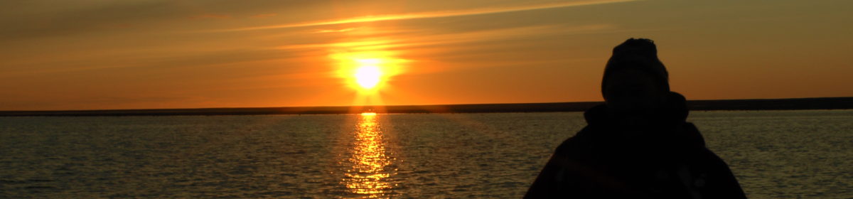
On our way back to Leverburgh, the boat sailed around the other islands and stacs where one could see another breed of sheep that were left when the islands were evacuated and are also living wild.
The little white dots on the green area are sheep living dangerously
The St Kilda archipelago is definitely worth a visit if you are in the Leverburgh area but you need to book in advance, be lucky with the weather and as advised by Kilda Cruises, allow two days for the trip, just in case the weather is bad on the intended day.
We left the Royal Hotel to drive to our next accommodation on the Isle of Harris on a Sunday morning.
A busy Sunday ‘A’ road on the Isle of Harris
If you are intending to travel in the Outer Hebrides you need to be aware that on a Sunday most businesses are closed and there is no public transport. Therefore, if you need to purchase supplies or refuel the car it has to be done on another day. There is a strong tradition of Christian church-going on the islands with Church of Scotland and Free Presbyterian Church being predominant. If you intend to eat out you will need to find one of the restaurants that does open and it is best to book a table, as the few that are open, are very busy particularly in the holiday season.
Our first visit on the way to our next accommodation was the Eilean Glas Lighthouse that is on the Island of Scalpay, North Harris.
North Harbour, Scalpay
In 1787 the original Northern Lighthouse Trustees approached Captain Alexander McLeod of Harris, the owner of Scalpay, to request that a beacon be erected on the island. The Northern Lighthouse Trustees preferred construction team was not available as they were building the Mull of Kintyre Lighthouse. McLeod’s own men independently started the construction in 1787, laid the foundations and raised the tower walls to seven feet. In 1788 the Trustees’ engineer, Thomas Smith, found that McLeod’s men had built the tower 4 feet greater in circumference than was planned. To save time and cost, they continued on the larger scale and the construction was completed in 1788. The lighting equipment was fitted in 1789 and the Lighthouse was first lit on 10 October 1789 with its first keeper, Alexander Reid, in situ.
The current Lighthouse
The current lighthouse was erected under the supervision of Robert Stevenson in 1824 and the lightroom was raised to 25 feet above the ground level bringing it to an elevation of 73 feet above sea level. In 1907 a fog signal was installed and the light was changed to one with a flashing character, although the fog signal was discontinued in 1987. In 2019, the lighthouse underwent a major refurbishment and upgrade with LED optics and a system that automatically makes a telephone call to the Northern Lighthouse Board headquarters to report faults in the event of failure of the light. Things have certainly changed from the days of the first lighthouse keeper.
The Lighthouse on a good day in the summer with the Minch, flat calmThe rusting fog signal that was discontinued in 1987
We then drove to our next accommodation near Leverburgh, South Harris through the main town on Harris, being Tarbert, and passing through places like Nisabost Beach.
Nisabost BeachThe beautiful scenery of South Harris
We had been told that the Outer Hebrides could have four seasons in one day but so far we had been lucky with the weather. The next day we had booked a trip to the St Kilda Archipelago, a World Heritage Site and National Nature Reserve, that lies 41 miles off the west coast of Benbecula in the Atlantic Ocean. We had been advised that a trip to St Kilda could easily fail due to the weather particularly the rough seas. We crossed everything for good weather and calm seas on the next day.
We made our way east of Stornoway to see one of the most important archaeological sites on the Isle of Lewis. This is St Columba’s Church UI (Eaglais na h-Aoidhe in Gaelic) which is believed to be the main church in the medieval period.
Archaeological finds showed that the area around the church had been settled by farming people in the Neolithic period up to 6000 years ago. Evidence of later occupation close to the church was found in 1937 when the remains of a small late Iron Age or early medieval stone building with a hearth on an earth floor and traces of iron objects were uncovered.
St Columba’s ChurchSt Columba’s Church
Under the Norse kings and later, until the 14th century as part of Scotland, Lewis was held by the Nicolsons who had strongholds at Flesherin and Stornoway. They may be responsible for the building of an early church on the site, a fragment of which is retained, embedded in the north wall of the building.
Inside the church
The Macleod dynasty, reputedly descended from Leod, a Norseman, obtained control of Lewes through marriage to a daughter of Torquil Nicolson, the last of the Nicolson chiefs. Torquil MacLeod was a son of this marriage. After the Treaty of Perth, when the islands became Scottish, they were first given by the King to the Earl of Ross and then to John, Lord of the Isles. Torquil MacLeod was confirmed as a vassal of the Lord of the Isles and probably died around 1380. The nave and chancel of the present church may have been built at the start of this period.
During the 14th century most of the Hebrides was brought together under a single Lordship. John of Islay was Lord of the Isles from 1354. The Lordship became virtually independent of the control of the Scottish Crown with Lewis continuing to the held by the MacLeods of Lewis (Siol Torcuil), the descendants of Torquil MacLeod.
This was a golden age of medieval society and Gaelic culture in the Western Isles. Justice was administered through the Council of the Isles and although warfare was a way of life, within the Lordship itself, peace was generally maintained.
The MacLeods of Lewis retained control of Lewis for 250 years or more with no fewer the 19 of their chiefs said to be buried at the church. There are two carved grave slabs commemorating Roderick MacLeod VII (died 1498) and his daughter, Margaret MacKinnon (died 1503).
A MacLeod headstone
We then returned to Lews Castle to have a look inside at the rooms and museum. When we were there the day before, it was late and the museum was closing for the night.
A room inside Lews CastleAnother room in Lews CastleA hall in Lews Castle
Lews Castle was completed in 1854 following Sir James Matheson’s purchase of the Isle of Lewis was taken over by Lord Leverhulme, of Lever Brothers/Unilever fame, when he bought the Isle of Lewis in 1918. In 1923, he gifted the Castle and grounds to the people of Stornoway. During the war, it was used as a naval hospital and latterly was the first home of the Lews Castle College until 1988. After many years of disrepair, the castle was renovated and now houses the museum, cafe and accommodation.
The Museum – Museum nan Eilean – is located in a purpose-built extension to Lews Castle and opened in 2016. The galleries look at the stories of the islands and islanders. Significant loans from the National Museums Scotland and the British Museum include the world-famous Lewis Chessmen.
The Lewis Chessmen
The eleven medieval chess pieces were part of a large hoard buried on the Isle of Lewis. The hoard contained 93 gaming pieces including at least four chess sets as well as other games.
It is thought that the chess pieces were made in the late 12th century or early 13th century in Norway. Chess is a very old game originating in the Islamic world and by the medieval period its popularity had spread across Europe. It was believed that it became an important part of medieval society, a way of practicing and demonstrating skill and strategy in a war-like setting. Boards for playing the games have been found by archaeologists at medieval sites in Scotland including monasteries like Whithorn (in Dumfries and Galloway). At Lewis, the hoard also contained pieces for playing the game of tables, a game similar to backgammon.
The style of the carving links the chess pieces to Norway. There is a similar chess piece in Trondheim. The Lewis chess pieces are mostly made from walrus ivory but some are made from sperm whale teeth.
After another enjoyable day we returned to the Royal Hotel in anticipation of our moving on to the Isle of Harris the next day.
To start our second day we headed west to Callanish (Calanais in Gaelic) to visit the Calanais Standing Stones. The standing stones are one of Scotland’s most magnificent and best preserved Neolithic monuments.
The Calanais Standing Stones
The Calanais Standing Stones are an extraordinary cross-shaped setting of stones erected 5,000 years ago. They predate the famous Stonehenge monument and are believed to have been an important place for ritual activity for 2,000 years.
It is not known why the standing stones at Calanais were erected but one theory is that they were a kind of astronomical observatory. As with many of these Neolithic monuments we will probably never be able to know what was in the mind of their builders.
Our next visit was to the Bostadh Iron Age Village on the island of Great Bernera. Bostadh means farm in Old Norse. The story of the site tells that during a severe storm in 1992, the stone walls of an ancient village were exposed that had lain hidden under the sand dunes of Bosta Beach for hundreds of years.
Bosta Beach
In 1996, the site was excavated to reveal a well-preserved settlement of houses that dated back to the Late Iron Age (or Pictish Age) of 400-800AD. Located in a small valley with streams, a beach and rich fishing waters it would have made a perfect home for these early people.
A Bosta Beach reconstructed houseIdeally placed for the beach and fishing
The excavation was recorded in detail and the footprint of the village was laid out. However, the vulnerable structures themselves could not be preserved due to the process of erosion and sand build up. Therefore, they again lay underneath the sand and a life-size construction of a period home was made as we see in the photos above.
Inside the reconstruction of the period home
We then drove back to Stornoway for a visit to Lews Castle that sat on the other side of the water from our hotel.
Lews Castle
In 1844 wealthy businessman James Matheson, a Scottish Opium Trader and co-founder with William Jardine of the Hong Kong based trading conglomerate Jardine Matheson & Co, bought the Island of Lewis for more than £190,000 from the bankrupt estate of the Mackenzies of Seaforth. Shortly afterwards he demolished Seaforth Lodge, the dilapidated home of the Mackenzies, taking on Glasgow architect Charles Wilson to design him a magnificent new island base – Lews Castle. A building this grand needed grounds to match and Matheson completely reshaped the landscape around his new home.
Matheson funded his grand scheme with a fortune that he had amassed following the first Opium War with China. To expand his business interests he had helped to persuade the British Government to wage war on China which had rejected proposals to legalise opium as it had become a problem for their people. The British Government used its naval power to defeat the Chinese in the first Opium War of 1839-42. This enable Matheson to expand his business empire into mainland China.
That said, Matheson provided employment, funded famine relief and engaged in many other social and economic projects to the benefit of the islands community, spending some £320,000 in 1850 (roughly £36 million today)
The view from Lews Castle towrds Stornoway town and port
Lews Castle these days provides luxury accommodation, is a wedding venue, has a museum, cafe and shops and one can stroll around the extensive gardens.
After a short walk back to our hotel, we again visited the Boatshed restaurant, part of the Royal Hotel, for an excellent dinner.
We arrived in Stornoway about 9.30pm and drove less than five minutes to our accommodation, the Royal Hotel that faces the harbour with Lews Castle on the other side of the water.
The Royal Hotel, Stornoway
Our first day dawned and we planned to go north to visit the Port of Ness (Port Nis, in Gaelic) and Butt of Lewis lighthouse at Lewis’s most northerly point. The plan was to then come back south visiting places of interest such as the famous, Blackhouses.
There are not many roads on the Islands so getting lost should not be an issue even if you are not using some form of satnav. There are many road signs which are in Gaelic with English underneath. The many Gaelic speakers on the Islands keep the language alive, although they also speak English so one does not encounter any issues when out and about.
Port Ness
Port Ness is a small community with a harbour and because it faces into ‘The Minch’ (the sea that separates the Islands from the mainland) at the very north of the Hebrides, its small harbour has been designed to deal with the worst storms.
In autumn, the men of Ness still make their traditional journey to Sula Sgeir to capture young gannets, a tradition that is believed started before 1549 when the gannets were collected for food. Sula Sgeir is now uninhabited, lies 70 kilometres north of Lewis and is one of the most remote islands of the British Isles. We didn’t see any gannet on the menu so perhaps the trip to Sula Sgeir is purely symbolic these days.
The “Butt of Lewis” lighthouse
A short way from the Port is the Butt of Lewis lighthouse that has been mentioned in the Guinness Book of Records as the windiest place in the UK.
The lighthouse was built between 1859 and 1862 by David and Thomas Stevenson on the cliffs, some of which reach 80 feet high. The Stevenson family’s involvement in lighthouse engineering began with Robert Stevenson whose grandson was the author, Robert Louis Stevenson known for works such as Kidnapped, Treasure Island and the Strange Case of Dr Jekyll and Mr Hyde. The cliffs comprise ancient rocks known as Lewisian gneiss which date back between 2.6 billion and 1.6 billion years. We were lucky that the wind was benign on the day we visited so our experience of the windiest place in the UK was positive.
We then returned south and visited the famous Blackhouse at Arnol. We understood that this particular house was still being lived in up to the 1960s when the occupants were moved across the road to a small conventional style house. For hundreds of years people were living with their livestock in Blackhouses which had advantages as it made the dwelling warmer and meant fewer buildings were needed.
The Blackhouse at ArnolThe space for the livestockThe space for storing equipmentThe main room with peat being burnt on the floorAll the mod cons of the BlackhouseBlackhouse sleeping cubicles
For authenticity, the peat fire was burning during our visit and you can see from the pictures that the smoke from the peat fire must have been a real health hazard. We understand that the fire was going all of the time so living with that every day and the animals in close proximity must have made the environment of the Blackhouse challenging.
That said, as there was no chimney, the smoke from the peat fire rose up into the thatch of the roof and killed bugs. It also made the smoke-laden thatch a good source of fertiliser for the fields.
We then visited the Gearrannan Blackhouse Village in the Carloway district which is a costal crofting village. Since 1989, the Garenin Trust has painstakingly restored the once-derelict properties and croft land to recreate an authentic settlement. Visitors can stay in the properties overnight on a self-catering basis.
Gearrannan Blockhouse VillageGearrannan Blackhouse Village
Some of the properties in the village are open to the day visitor so that they can see the different interiors as well as some demonstrations of traditional crafts such as weaving the famous Harris tweed.
Traditional weaving
We then moved on the short distance to the Dun Carloway Broch. Brochs are among Scotland’s most impressive prehistoric buildings and these stone roundhouses date from about 2,300 to 1,900 years ago, and are found mainly in north and west Scotland. Probably built to reflect the prestige and status of their inhabitants, brochs were primarily dwelling-places for the principal family in the area. They would have provided some protection against sporadic raiding, but were not purely defensive structures.
The Dun Carloway BrochThe landscape around the Broch
After a full day of blackhouses and brochs we returned to the Royal Hotel, that just happened to have one of the best restaurants in Stornoway, for sustenance and a good night’s sleep.
Having travelled on many trips to Scotland over the years – including Orkney, Shetland and the Inner Hebrides – the Outer Hebrides, or Western Isles as they are alternatively known, was the last part of Scotland that we had not had the pleasure to visit.
The Outer Hebrides
The Outer Hebrides are made up of many inhabited and uninhabited islands, the principal ones being Lewis, Harris, Uists, Benbecula and Barra. Our intention was to drive up to Ullapool on the west coast of Scotland and take the ferry across to Stornoway on the Isle of Lewis to start our trip. This was a drive of 636 miles with an estimated drive time of around 11 hours, so we decided to make a stop just outside of Glasgow for the night, at Motherwell which was a mere 400 miles.
The drive to Motherwell was virtually all on the motorway but from Motherwell to Ullapool the roads were very good, but mainly single lanes so the last 200 miles were slower. Part of the route we took from Inverness was on the NC500 – the 516 mile scenic route that goes around the North Coast of Scotland. The NC500 is a nice trip to make as it takes one to parts of Scotland not normally visited by most tourists. We made this trip many years ago before it became the tourist event it is now.
Ullapool is situated on Loch Broom
After reaching Ullapool we caught the ferry for the voyage across to Stornoway which takes circa 2hr 40 minutes. Before travelling we had engaged a local travel agent in Stornoway to book us accommodation in the Outer Hebrides as this is limited and in the peak season can be difficult to find. The other peculiarity that travellers to the Outer Hebrides need to be aware of is that, on a Sunday, most shops, petrol stations and restaurants close all day, so if you want to eat you need to book in advance in the few restaurants that do open. It was just like the rest of the UK used to be in the 1950s. Also there is no public transport on a Sunday.
Ullapool on a July day
The structure of our trip was to start on the Isle of Lewis and drive down the islands, visiting various historical and cultural sites including the World Heritage Site, St Kilda (Hirta), finishing on the Isle of Barra where we would get the ferry from Castlebay back to Oban on the mainland of Scotland.
Words and photos: Copyright John Cruse 2024. Map courtesy of d-maps.com
Our route from Tahiti to Valparaiso (courtsey of Silversea Cruises)
Our final trip of 2022 is fast approaching. Yet another trip booked pre-Covid and shelved for a couple of years. As can be seen from the route map above, it is an exploration cruise from Tahiti, French Polynesia across to Valparaiso, Chile, visiting the many islands that are situated inbetween. Our friends in Australia, Eric and Diane, alerted us to this trip and we could not miss the opportunity to visit such a remote British Overseas Territory, the Pitcairn Islands, which were the main thrust of our interest in this trip.
I am sure that many of you will have read the books and seen the films about the Mutiny on the Bounty which happened in 1789. The reason I mention this is because some of the mutineers and some Polynesian men and women hid on the Pitcairn Islands (Adamstown) and remained undiscovered from 1790 until 1808.
For those unaware of the story of the mutiny on the HMS Bounty, it was captained by Lieutenant William Bligh and was engaged in transporting breadfruit from Tahiti to the British colonies in the West Indies. The expedition, which left England in October 1787, was promoted by the Royal Society and its president Joseph Banks who believed that bread fruit would grow in the West Indies and be a cheap food for the slaves in the sugar plantations. After sailing around Cape Horn and into the South Pacific Ocean, the mission was to pick up bread fruit in Tahiti and take it to the West Indies via the Indian and South Atlantic Oceans.
The crew consisted of 46 men, 44 Royal Navy seamen and two civilian botanists. This included a 23 year old Fletcher Christian, Master’s mate, who came from a wealthy Cumberland family descended from Isle of Man gentry. He had twice voyaged with Bligh to the West Indies and served on the Bounty without pay as one of the “young gentlemen”.
Bligh enforced strict discipline on the ship and when men stepped out of line, punishment was dealt out. There were clashes between Bligh and his officers on the trip down to Tahiti so when they reached Tahiti, the 5 months stay to collect bread fruit must have been a relief for Captain and crew. It seems that many men were not happy to leave the attractions of Tahiti, particularly the promiscious women, as they had enjoyed their time there. It seems that Fletcher Christian’s mood was not generally good and it did not help when, back at sea, Bligh accused him of stealing coconut from Bligh’s personal supply.
A mutiny ensued on 28 April 1789 and Bligh and some of his loyalists were cast off in the ship’s largest open boat. Bligh and his loyalists finally made it back to England in March 1790. The mutineers returned to Tahiti and some stayed there but Fletcher Christian and 8 others mutineers, along with 20 Polynesians (6 men and 14 women) left finally arriving in the Pitcairn Islands.
There is a lot more to the Mutiny on the Bounty, a true story, which is well worth reading as the above is only a very short precis. I would not suggest watching a Hollywood film on the Mutiny as Hollywood tends not to let the truth get in the way of a good storyline.
The above story tweaked our interest in this trip but I am sure there will be much else to report on as we visit French Polynesian and the Chilean Islands on our way across to Valparasio. We have visited Easter Island before so it will be interesting to go back and see what may have changed in the last 22 years.
We are back and as expected wifi was in most places non-existent so we were not able to post daily updates.
Eagle hunters with the Mongolian flag
That said, for this trip, we have decided to post on various topics rather than specific days. The trip was split into two sections, a circular drive from Ulaanbaatar (UB as it is known to the locals) through mid-Gobi, down to South Gobi and the Sagsai Eagle Festival which was held in the far west of Mongolia in the mainly Kazakh province of Bayan-Olgii Aimag.
Mongolia is not a country I knew much about before going there so I though I would set out a few facts. It is nearly 6 times the size of the UK and has a population of 3.2 to 3.4 million with half of those living in and around UB. UB is a sprawling city with many new apartments being built as more Mongolians desert the nomadic life and move to the city for a different style of existence. Those still out in the vast countryside do continue to embrace a nomadic lifestyle and their wealth is measured by how many sheep, goats, camels, cows and horses they have. Fellow travellers of ours were asked by a nomadic family how many animals they had, and when they said one dog and two cats, they were asked, “are you poor”.
So a very different way of life for many in Mongolia compared to the western world. That said, all the nomadic families have mobile phones and satellite tv so are not as “cut off” as one may think from the outside world. Those who follow the nomadic life live in “gers” for the summer and nowdays move to a small house in the winter when it can get down to -50 centigrade. Living in a ger in those temperatures would be harsh as we found out to a lesser extent when we visited the Eagle Festival.
Our Ger at Sagsai Village, no problems with neighboursThe inside of our Ger at Sagsai Village
As you would expect, Mongolia’s history is linked heavily with its two big neighbours, Russia to the north and China to the south. Mongolia had been ruled by the Chinese Qing dynasty for circa 300 years until 1911 when a revolution broke out and on 1 December 1911, Mongolia declared independence. This ushered in the Bogd Khan era (Emperor of Mongolia) which lasted until 1924 after which Mongolia became a socialist state until 1992 under the leadership of the Mongolian Peoples Revolutionary Party. During this period Mongolia had close ties with the USSR. Today Mongolia is an independent country although we were told that many Mongolians are not happy with the current Government, who have a stranglehold on politics in Mongolia. It seemed that people were very sceptical as to how the Government was using tax payers’ money, so nothing new there.
Most Mongolians are Buddists and the Kazakh’s over in the west of the country are Muslims. There were many Buddist monastries dotted around the country, usually at the top of a hill, and in the west many mosques. Islam seems to be much more relaxed in the west with the Kazakh people – no head scaves or other dress code and many people preferred to worship at home rather than go to a mosque. For those muslims living out in the wild as nomads, worshipping at home seemed very sensible.
Mongolians drive on the rightside of the road but I have never been to any country that has so many cars with the steering wheel on the wrong side ie the right side. Also, I have never been to a country where the majority of vehicles are Toyota Prius. We were told a politician in the ruling party was able to purchase a vast amount of Toyota Prius’s directly from Japan and sell them on to the populus. It was very interesing seeing Mongolian drivers trying to overtake lorries and having to get the whole car out on the wrong side of the road.
Coming to roads in Mongolia, those who had seen the Top Gear special would probably have got the impression that the road system in Mongolia was very underdeveloped. It certainly is and 95% of our travel was off road on varying levels of rough terain. Lucky our drivers had the UAZ Van, a Russian vehicle that can still be bought brand new today, that is good off road but not so good on tarmac.
More to follow.
If you have any problems seeing pictures on the e-mail you receive, please go to the actual website where they will be in glorious colour.
Our next trip starts this week and we are off to Mongolia for a journey into the Gobi Desert and then to see the Eagle Festival which is held in the west of the country.
As can be seen from the map above, Mongolia lies between Russia to the North and China to the South and I understand it is roughly the size of Alaska. Mongolia is the 19th largest and the most sparsely populated independent country in the world, with a population of approximately 3 million people. It is also the world’s second-largest landlocked country after Kazakhstan.
The country contains very little arable land, as much of its area is covered by steppes, with mountains to the north and west and the Gobi Desert to the south. Approximately 30% of the population is nomadic or semi-nomadic, and 45% live in the capital Ulaanbaatar. There are no other major cities in the country with the next largest, Erdenet and Darhan, having populations of 100,000 and 80,000 respectively. The highest point in Mongolia is Nayramadlin Orgil (also known as Mt Khuiten), at 4,374 meters (14,350 feet).
I am sure that many of us have heard the term Outer Mongolia. Interestingly, Inner Mongolia refers to the northern portion of China that borders with Outer Mongolia which is actually the country of Mongolia as we know it today. This division, I understand, was formed in the 1600s during the expansion of the Qing empire. In 1911 Outer Mongolia declared its independence after the fall of the Qing dynasty.
The life expectancy is 65 for men and 73 for women, the major religion is Buddism and the official language is Khalkh Mongolian.
After we leave the capital, Ulaanbaatar, and head south to the Gobi Desert we will be staying in ger camps which have 2-4 beds each and a traditional wood burning stove. No doubt this is 5 star luxury Mongolian style. We will find out soon.
As there will not be good, or possibly any, internet connections outside of Ulaanbaatar, our postings will most likely come at the end of our trip, so stay tuned.
Copyright: Words John Cruse 2022 (route map courtesy of Goyo Travel)