If you travel with us by reading our posts and are wondering what has happened to our posts in 2023, the answer is, we have been travelling but, for various reasons, not posting.
This will be rectified in due course and we will catchup with posts for our 2023 travels to South Korea, The Outer Hebrides, Northern Ireland and Egypt.
Our travels for 2024 are all planned and we will be posting our first 2024 posts shortly.
The next day we left Cradle Mountain for our last stop in Tasmania – Launceston.
On the road in Tasmania
On the outskirts of Launceston is an area called Youngtown where the National Trust of Australia have a site, called Franklin House.
Franklin House
Franklin House was built in 1838 by a former convict Britten Jones – an innkeeper and brewer – as a gentlemen’s residence next to a small farm. The house was built in a neo-classical Greek revival style using convict labour and the farm was recorded as having pigs, sheep, fowl, a cow and a horse for Britten Jones to ride.
The reception room in Franklin House
Britten Jones leased the house in the 1840s to various tenants and in 1842 it was leased to, and eventually bought by, George Keeler Hawkes, a schoolmaster who set up a Classical and Commercial School, known as ‘Mr Hawkes Academy’. The school became one of the leading educational establishments in the colony and charged 45 guineas a year for full board and tuition fees (approximately just under seven thousand pounds today). School hours were long and, apparently, Hawkes was a hard taskmaster and was not adverse to using the cane on his charges. The school closed in 1866 when Hawkes was then elected to be a member of the Tasmanian Legislative Council.
The garden at Franklin HouseThe garden at Franklin House
In the 1850s seeds arrived from England and the flower garden was planted, including snapdragons, stocks, pansies, hollyhocks and sunflowers. The gardens are still there today and were a pleasant place to stroll around after visiting the house.
The Garden plan for Franklin House
Hawkes died in 1882 and his wife lived in the house until her death in 1886. Then his sister lived there until her death in 1888. After that the house was owned by three families until in 1945 it was purchased by Thomas Poole and his family who lived there until it was sold in 1960 to the newly formed National Trust in Tasmania for £5,000. They renamed the house after the nearby Franklin village that had been engulfed by the expansion of Launceston.
Fountain made in England in circa 1870 by the Coalbrookdale Company
After Franklin House we drove further into Launceston that sits on both sides of the Cataract Gorge Reserve.
First Basin at Cataract Gorge
There are many walking/bike trails around the Gorge area and a Gorge Scenic Chairlift. Apparently the Tasmanian Tiger once roamed areas like this.
A walking path at First basin
The Gorge was a very popular destination with local people particularly with the nice weather on the day we visited. There was also some wildlife in the Gorge.
An Indian Peafowl
This was our last day in Tasmania as we fly back to the mainland tomorrow to explore Melbourne. Tasmania is definitely worth visiting with its history and wildlife as part of any trip to the Australian continent.
Copyright: Words and photos (except garden map of Franklin House) John Cruse 2025
The next day we visited the Cradle Mountain National Park. The National Park is situated in the heart of the 1.4 million hectare Tasmanian Wilderness World Heritage Area.
Cradle Mountain National Park with Cradle Mountain dominating the landscape
The National Park has a Visitor Centre where one can purchase an entry ticket (day pass) for A$28 per person. From the Visitor Centre, a bus runs the 6 kilometres down to Dove Lake, with intermediate stops, for the start of the walking trails.
Cradle Mountain National Park map with walking trails
There are many different walking trails with the short walks all being under 3 hours walking time. The National Park also boasts that visitors can see wildlife, go canyoning or take a scenic helicopter ride. ‘Canyoning’ is where people throw themselves into a fast flowing mountain stream and get carried down stream at high speed. We decided to give this a miss.
We took the bus down to Dove Lake and decided to take the Dove Lake circuit walk which is a 6 kilometre track and takes about 2 to 3 hours depending on stops.
The Dove Lake circuit track
The track we walked was very well maintained and although it undulated, it wasn’t difficult walking. There were many good views around the lake with good opportunities for taking photos.
A Dove Lake beach with Cradle Mountain in the backgroundA beautiful day at Dove Lake
After our walk we went back to Devils@Cradle for our ‘After Dark Wildlife Tour’. As many of the indigenous animals are nocturnal, a visit after dark gives one a different perspective of the animals.
Eastern Quolls having an early evening dinnerA Spotted-tail Quoll having an early evening dinner
The tour guide – one of the keepers – gave some commentary on each type of animal, its traits, and how they are trying to reintroduce them into the wild.
As the sunset and night descended we enjoyed a drink and some snacks whilst watching the animals although it was very dark and not at all good for photography as flash, understandably, was not allowed.
Copyright: Words and photos (other than Cradle Mountain National Park map) John Cruse 2025
Most of the day was spent driving the 185 miles to Cradle Mountain from the Freycinet Peninsula. We found the roads in Tasmania fairly good but as they were all single carriageway, the drive took a lot longer than using a motorway.
The open roads of TasmaniaThe 185 miles was a scenic drive
We arrived at our accommodation, Cradle Mountain Hotel, in good time for our early evening visit to Devils@Cradle.
Devils@Cradle runs conservation programs for Australia’s three largest carnivorous marsupials – the Tasmanian devil, the Spotted-tail quoll and the Eastern quoll. All three of these species are currently listed as either threatened or endangered in the wild and all occur locally in the Cradle Mountain area.
We were told that as these marsupials are nocturnal, the chances of seeing them in the wild at night was unlikely so the trip to Devils@Cradle was the best option.
Young Tasmanian Devils
The tour at Devils@Cradle gives an overview of the plight of the marsupials and how the conservation programmes are trying to reintroduce them into the wild.
We were told that Devils@Cradle is a privately-owned, conservation-based, breeding facility that is involved in two national conservation programmes focusing on the three species of marsupials. They also rescue, raise and release orphaned or injured wildlife.
The Tasmanian devil is the largest of the world’s carnivorous marsupials, with males and females weighing around 10 kilos and 7 kilos respectively, larger males can reach 11-12 kilos. The Tasmanian devil got its name from early European settlers who were alarmed by its loud, high-pitched screams and growls. The settlers thought they were hearing sounds coming from a demon or devil in the bush at night. We heard these sounds when the young devils were feeding and one can understand why the early settlers thought as they did.
The devil is a solitary species which has evolved into a very effective scavenger. They have a strong build and powerful jaws capable of crunching and consuming bones efficiently. The devil is an opportunistic hunter and will eat almost anything from insects, amphibians and reptiles through to larger species such as possum, wallaby and wombat. They rely largely on their sense of smell and their endurance when searching for food. We were told that their lifespan is believed to be 5-6 years in the wild and up to 7 years in captivity.
The devil is very adaptable and finds suitable habitat throughout Tasmania’s diverse landscape, from the alpine mountainous areas (such as Cradle Mountain) through to the coastal environments surrounding the island. Currently the species is only found in Tasmania and is believed to have been forced into extinction on mainland Australia following the introduction of the dingo. The species has recently been classified as ‘endangered’ following a decline of up to 85% across its natural range due to a contagious facial cancer known as Devil Facial Tumour Disease (DFTD). In addition to DFTD, another major threat to this species is roadkill – with a smorgasbord of carrion available along the highways the devils will gravitate to them, so drivers need to take care when travelling Tasmanian roads after dark.
A Spotted-tail Quoll
The Spotted-Tail quoll is the largest of the quoll family, native to Australia and Papua New Guinea, with males and females weighing around 4 kilos and 2 kilos respectively. Two subspecies are recognised, the smaller northern Queensland subspecies and a larger one which is found in small numbers in southeastern Australia and Tasmania.
Largely territorial, they are considered an apex predator with their prey consisting of insects, crayfish, lizards, snakes, birds, domestic poultry, small mammals, platypus, rabbits, arboreal possums, pademelons, small wallabies, and wombats. As this suggests, they are capable of predating on animals much larger than themselves. Their lifespan is 3-4 years in the wild and up to 6 years in captivity.
They are found throughout Tasmania, which is considered their last stronghold, but also exist in patchy distribution along the east coast of mainland Australia. We were told that they live in a variety of habitats, but seem to prefer wet forests such as rainforests and closed eucalypt forest.
This species is vulnerable to decline with the main threats being habitat loss and fragmentation, roadkill, competition from foxes on the mainland, feral cats, illegal poisoning, and trapping and shooting, due to the fact that they will kill poultry.
Eastern quolls
The Eastern quoll is a small to medium-sized carnivorous marsupial native to Australia, with males and females weighing around 2 kilos and 1 kilo respectively. It is a fast and agile solitary predator, hunting at night for its prey of insects and small mammals. It has also been known to scavenge food from the much larger Tasmanian devil. We were told that their lifespan is 3 years in the wild and up to 5 years in captivity.
Eastern quolls are unique among the quoll species. They are the only species that can be found in two completely different fur colours – fawn and black (referred to as a ‘morph’). The fawn morph is more common as only 25% of Eastern quolls have black fur and both sexes can be either colour.
Their habitat is varied and consists of alpine areas including grasslands, heathland and rainforest through to dry grassland and forest areas bounded by agricultural land and also some coastal environments.
They were once found across south-eastern Australia, but are now only found in the wild in Tasmania. Feral foxes and cats, as well as habitat loss and disease, caused their extinction on the mainland. The last sighting of Eastern quolls on the mainland was in the 1960s. The lack of foxes and dingoes in Tasmania is believed to have contributed to the survival of the species here on the island. Today, the main threats to the Eastern quoll is roadkill, habitat loss, insect decline, competition and predation from feral cats and illegal poisoning and trapping as people often confuse this species with the larger Spotted-Tail.
Eastern Quoll
Visiting Devils@Cradle is a must for anyone interested in the endemic fauna of Tasmania, so much so we had booked a night visit the next day.
After arriving in Wineglass Bay on the Freycinet Peninsula the evening before, we had a boat trip to look forward to today. The area is a National Park so has many visitors as it offers a variety of coastal activities, such as walks and water sports.
The view from our accommodation over Wineglass Bay
There are several walks, from easy and short to a three days trip around the Peninsula. The water activities included swimming and snorkelling, but as we were only staying for the one day we opted for a cruise on Wineglass Bay.
As one would expect, there is wildlife in the area and we were hoping to see some sea birds, dolphins, seals and whales.
Australian Fur Seals on Refuge Island
The cruise lasted for just over 4 hours and included lunch and a commentary on the wildlife, the rock formations, the caves and blowholes that exist around that part of the coast. As with any wildlife spotting, one has to be lucky on the day and we did not see too much at close quarters apart from the seals.
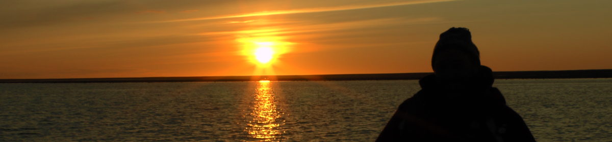
A sea caveSunset at Wineglass Bay
That said it was still a nice day and we were lucky to spot some wildlife whilst eating dinner at our accommodation.
An Australian Possum having its dinner
The next day we had a 185 mile drive to Cradle Mountain where we had an evening tour planned for spotting the legendary endangered Tasmanian Devils and Eastern Quolls.
We returned to the Port Arthur Historic Site the next morning to explore the parts of the site we did not get to the previous afternoon.
The Government Gardens at Port ArthurThe Government Gardens
The Government Gardens at Port Arthur were first developed in 1846/47 by Commander Champ. The gardens today are a reconstruction of the originals which were laid out as a place where visitors and residents and their families could get some fresh air away from the presence of the convicts.
After the site was closed in 1877, the original garden fell into neglect until reconstruction began in 1991. The reconstruction was achieved using photographs, drawings and descriptions from the mid-19th century. The plants used today were varieties present at the Queens Domain in Hobart during the late-19th century including those familiar in England, such as violets and foxgloves, to more exotic plants from Africa, South America and Asia.
The Government Cottage sitting above the Government GardensThe Church next to the Government Building
The Government Cottage was built to accommodate government officials and other important visitors to Port Arthur. The Cottage was burnt down when a bush fire devastated Port Arthur in 1895 and was not rebuilt but has been preserved. Next to the Cottage is the Church which played an important role in the reform of the convicts. The Church was destroyed by fire in 1884 but has also been conserved so that the work of the convicts who built it can be appreciated.
In addition to the Penitentiary that housed the better behaved prisoners, the site had the Separate Prison. The Separate Prison was opened in 1849, supposedly modelled on Pentonville Prison in London, and was designed to deliver an alternative to corporal punishment. The convicts were locked in their cells 23 hour each day with one hour allowed for exercise. Those who continued to offend were sent to the punishment block within the Separate Prison.
Cells in the Separate PrisonA Separate Prison cellA Separate Prison cellThe Chapel in the Separate Prison
The Separate Prison has been restored which brings the building to life for visitors.
The reconstructed Separate Prison
It is reported that the convicts in the Separate Prison had to undertake some form of labour in their individual cells. When they did leave their cells, the convicts had to wear a hood to hide their face. They weren’t allowed to communicate with anyone and were referred to by their number rather than name. The Chapel was interesting as the wooden cubicles held one convict who, due to the construction, could not see the person in front or on either side of them. As they were led into the Chapel hooded, they could not see anyone and were not allowed to make any noise. The corridors of the Separate Prison had mats laid on the floors so that the convicts did not make a noise as they walked around the Prison. This was all part of the sensory deprivation treatment they were subjected to.
The Guard Tower in the Military District of Port Arthur
The Guard Tower sits above the site and was built by 1836 with flanking walls to secure the military barracks and allowed the military guards to have a good view of what was going on across the site.
After a morning at Port Arthur, we drove the 140 miles to Wineglass Bay on the Freycinet Peninsula.
As Day 7 dawned we set off to drive the 60 or so miles to Port Arthur which is south of Hobart. We had pre-booked entry tickets for the Port Arthur Historic Site which is a must visit for those interested in the history of Tasmania. The site is large so we had allowed a whole day for our visit, split over an afternoon and the next morning. There are guided tours which are best booked in advance as they are popular.
Port Arthur Historic Site Visitor Map (copyright Port Arthur Historic Site)
The Port Arthur penal station was established in 1830 as a timber acquisition area. The convict inmates of the site were deployed to produce sawn logs for use in Government projects. From 1833, the site became a punishment station for repeat offenders from all the Australian colonies.
Port Arthur today
Presumably, like many other penal establishments of its time, Port Arthur was built on a philosophy of discipline and punishment, religious and moral instruction, classification and separation, training and education. This system broke many men, whereas others left rehabilitated, educated and with skills.
Port Arthur todayPort Arthur today
By 1840, in excess of 2,000 convicts, soldiers and civilian staff lived on the site and it was a major industrial settlement. It produced a range of goods including worked stone, bricks, furniture, clothing, boats and ships.
With transportation to Van Diemen’s Land ceasing in 1853, the site at Port Arthur changed to become an institution for aging, as well as physically and mentally ill, convicts. The site was finally closed in 1877 at which time many of the buildings were dismantled or destroyed. Tourism began to the site almost immediately after closure and continues today.
Port Arthur in the 19th centuryPort Arthur in the 19th century
Port Arthur was recognised as a place of historic interest in 1916 and by the 1920s some of the period buildings had become museums, hotels and shops. In 1971, the National Parks and Wildlife Service took over the management of the site and by the 1980s parts in private ownership were acquired and conserved by the State Government. In 2010, this site and 10 others were included on the World Heritage List as the Australian Convict Sites World Heritage property.
Something we were not aware of until we visited the site was the tragic event that unfolded on 28 April 1996 on and around the area of the site. A gunman took the lives of 35 people and wounded 19 others. There is a memorial plaque at the site dedicated to the deceased and injured. It is situated in the memorial garden where the massacre started – within the original tea shop. The massacre resulted in a fundamental change to the gun laws in Australia.
The Port Arthur Historic Site is on the coast and just off the shore in the bay is the Isle of the Dead. The reason for the name is that there is a small cemetery on the island which is the final resting place of 1,000 convicts, military and civilian officers, and women and children. The deceased were buried there between 1833 and 1877 with the convicts being buried in a separate area to the others. Originally the convicts were laid to rest without headstones, whereas the other people buried there did, but this was rectified in 1850 when some of the convicts were given headstones.
The Isle of the Dead
It is possible to go on a guided cemetery tour on the Isle of the Dead but places are limited so booking in advance is advisable. Part of the ticket we purchased included a harbour cruise which takes one out into the harbour and around the Isle of the Dead, but if one wants to actually visit the cemetery a separate ticket needs to be booked.
Remanants of ship building at Port Arthur
We had not managed to see all parts of the site in one afternoon so we had allowed the next morning to come back and complete our visit. The tickets sold to us covered two consecutive days which was ideal considering the size of the site.
Copyright (other then visitor map): Words and photos John Cruse 2025
After the Blue Mountains we were again following our aborted 2020 itinerary and flying to Tasmania the next day.
Tasmania is an island state separated from the south of the Australian mainland by the Bass Strait. The state capital and largest city is Hobart with, it is estimated, 40% of the population living in the greater Hobart area.
Tasmania has an interesting history from the early aboriginal settlers, who were cut off from the mainland around 10,000 years ago, to the European settlers when the British colonised the island in 1803 and used it as a penal settlement.
Tasmania was first sighted by a European when Abel Tasman landed at today’s Blackman’s Bay in 1642. It was named Van Diemen’s Land after the sponsor of Abel Tasman’s voyage, Anthony van Diemen who was the Governor-General of the Dutch East Indies. The British retained this name when they established a settlement in 1803 with the name being changed in 1856 to Tasmania to distance itself from its history as a harsh penal colony.
We collected a hire car at Hobart Airport with a view, over the next seven days, to driving to Hobart, Port Arthur, Cradle Mountain and finally Launceston.
Hobart was not a big city so we had arranged a guide to give us a walking tour of the more historic areas.
The Sir John Franklin statue in Franklin Square, Hobart
Sir John Franklin, later to become infamous due to his voyages to find the North West Passage, was the Lieutenant-Governor of Van Diemen’s Land from 1837 to 1843. He will be remembered, along with is wife, for the efforts to improve and develop the colony by establishing a public school system and founding the Tasmanian Natural History Society.
A statue of William Lodewyk Crowther
Also in the park at Franklin Square was a statue of William Lodewyk Crowther who was the Premier of Tasmania from 1878 to 1879. He was apparently a controversial figure as he was suspected of allegedly mutilating the remains of an aboriginal man, named William Lanne in 1869. He was suspected of removing Lanne’s skull and sending it to the Royal College of Surgeons in London. Due to this history, the Hobart City Council voted to remove Crowther’s statue as an act of reconciliation. Prior to this happening, in May 2024 the statue was vandalised when a tool was used to cut through the legs and graffiti was sprayed on the plinth. This seems to be happening in many cities around the world these days where some people want to cancel history rather than learn from it.
The Treasury Building in Hobart
Hobart is a mixture of the old and new like many cities and some of the houses in the nearby suburbs are just as interesting as the government buildings.
The entrance to Kelly’s Steps
We then made our way up Kelly’s Steps to the Battery Point area of Hobart that sits above the port. This area has some 19th century houses and although not far from the port is a lot quieter but well worth a visit.
A Battery Point houseAnother Battery Point houseLenna of Hobart, now an hotel, at Battery Point
A house, known as Lenna of Hobart, used to be the only one at its location overlooking Battery Point when the foundation stones were laid in 1860. The original house where Lenna (which is a Tasmanian Aboriginal word for ‘house or hut’) stands was built by whaling Captain James Bayley who sold it to his business partner, Alexander McGregor, who had married Bayley’s sister, Harriett. The house has a lookout turret where Alexander McGregor was able to keep a watch for his returning ships.
Harriett and Alexander McGregor
Our local guide was friendly with the hotel owners so we were able to go up to the lookout turret and enjoy the sights over Hobart harbour.
The stairs in the LookoutA contemporary view from the Lookout towards the harbour
The view from the Lookout over Battery Point has obviously changed dramatically since Alexander McGregor used to look for his ships returning to the harbour in the 19th Century. The Hotel contains a lot of pictures and artefacts that relate to its history and previous ownership so is definitely worth visiting.
Our morning tour finished here so we made our way further down the other side of Battery Point. Battery Point was originally named after the Mulgrave Battery that was established in 1818 as part of Hobart’s costal defences. The Battery was found to be in a poor strategic location and was eventually decommissioned in 1878. The site was given to the Hobart City Council for recreation and the area became a fashionable suburb known for its historic houses and colonial architecture.
The Semaphore Cottage in Princes Park, Battery Point
The Semaphore Cottage is the oldest building at Battery Point, being built in 1818 as part of the Mulgrave Battery. It was a key part of the Hobart Port signalling system and evolved into Australia’s most extensive semaphore signalling system linking Hobart with Port Arthur and southeastern Tasmania. As one of the oldest surviving buildings in Hobart it represents an example of old Colonial Georgian architecture. We understand that it did open to the public on some days but unfortunately not when we were in Hobart.
Our afternoon visit was to the Cascades Female Factory Historic Site which was a penal colony for women from the early part of the 19th century. The site today is a mixture of buildings and the outlines of where the actual buildings stood.
The Cascades Female Factory
The factory opened in 1828 with one yard and by 1853 it had five yards operating. The opening of the fifth yard coincided with the last year of transportation. The site for the Female Factory was purchased in 1827 by Governor George Arthur, from Thomas Yardley Lowes the owner of a failed distillery.
The site of the Female Factory today
The first intake of female prisoners arrived in 1828 and gradually expanded to 700 with the female convicts and their children. At its peak, it was very overcrowded holding 1,200 women and children.
When the first women were sent to the Cascades, the Rules and Regulations for the management of the House of Correction were issued to the Principal Superintendent. The rules outlined the staff required to manage the establishment being a Superintendent, a Matron, an Overseer and Task Mistress for the Crime Class, a Porter, a Clerk and two Constables. They also stipulated how the women were to be divided, in both class and duties. Governor Arthur insisted that the women be placed in three distinct classes that ‘on no account be suffered to communicate with each other’.
The first class was to consist of women recently arrived from England who exhibited good behaviour on the journey (as reported by the surgeon on-board), as well as those returning from service with good characters and those who had successfully seen out their probation in second class. First class alone was considered assignable, and the women were sent to service when the appropriate employment could be obtained.
The second class was to comprise those who had been guilty of minor offences and those who, by their improved conduct, merited removal from the crime class. The crime class was the lowest rung on the ladder, comprising women who had been transported for a second time; those guilty of misconduct on their journey to the colony; those convicted of offences before the Supreme Court; or those who committed offences within the walls of the factory.
The class system regulated both clothing and daily tasks of the women while in the factory. The first class women were employed as cooks, task overseers and hospital attendants. Second class convicts were employed in making clothes for the factory and preparing and mending linen. The crime class was sentenced to the washtub – laundering for the factory, the orphan school and the penitentiary; they also carded and spun wool. All of these tasks were subject to change at the discretion of the Principal Superintendent.
November to March saw unrelenting hours of labour, with the shorter days in winter being the only respite. As the sun did not set until after dinner for a large part of the year, the women were working up to 12 hours a day and even the slightest disobedience to the rules was punishable.
To finish our day, we drove to the top of Mount Wellington that sits above Hobart and is part of the Wellington Park Reserve. The summit of Mount Wellington is 21 kilometres west of Hobart’s Commercial Business District and has some great views over Hobart and the harbour.
The day we left Australia in 2020, because of the Covid shutdown, we should have been going to the Blue Mountains. The mountains are supposedly named after the blue haze that hangs over them, and our trip involved a whole day’s travel from Sydney which, in our case, started at the Calmsley Hill City Farm with its menagerie of native and farm animals.
An Australian native, the KoalaA WombatOne of the not so elusive marsupials
As spotting the native marsupials in the wild can be hit or miss, visiting the farm does give tourists the opportunity to see some of the more elusive animals.
The Blue Mountains National Park has many ‘lookouts’ with some fantastic views over the surrounding rock formations, such as the Three Sisters from the Eagle Hawk Lookout.
The Three Sisters from Eagle Hawk LookoutThe view from Govett’s Leap
After the various lookouts, we visited the Blue Mountains Botanical Gardens on Mount Tomah.
The Botanical GardensThe Botanical GardensThe Botanical Gardens
The Blue Mountains Botanical Gardens were free to enter and are the highest in the southern hemisphere at 1,000 metres above sea level. The Gardens are located in a UNESCO World Heritage area and feature a cool climate collection of the Botanical Gardens of Sydney.
The Wollemi Pine
The Gardens have some examples of the critically endangered Wollemi Pine that is endemic to Australia and is believed to be one of the oldest and rarest trees in the world estimated to be able to live between 500 to 1,000 years. The tree was thought to be extinct until it was discovered in 1994 by a bush walker in the Wollemi National Park, just outside of Sydney.
The blue haze was not very evident during our trip to the Blue Mountains but it was a very interesting day with some great views and the chance to get up close and personal with some marsupials.
Just across the other side of Darling Harbour from our accommodation was the Australian National Maritime Museum. The Museum illustrates the earliest water craft such as canoes and the story of voyaging by Australia’s first peoples through to more modern vessels that are moored in the harbour outside of the Museum.
An example of the diverse canoes of Australia’s first peopleOne of the more ‘modern’ sea craft that is moored outside of the Maritime Museum
The Maritime Museum also covers the histories of the explorers who found and charted Australia such as the British Naval Officers Lieutenant Matthew Flinders and Lieutenant James Cook. It also covered the methods of how they navigated when calculating latitude (distance north and south) at sea which was relatively easy, but longitude (distance east and west) was much harder. This issue was so important that the British Government established a Board of Longitude in 1714 which offered large cash prizes for “such persons as shall discover the longitude”.
The longitude problem was widely recognised as an issue of keeping accurate time at sea. As the earth rotates through 15 degrees of longitude every hour, time comparison could be made with the time at a reference point. Greenwich in England was chosen as the reference location, but in the 1700s what clock could work accurately on a rolling sea? Clockmakers set to work and eventually John Harrison, who over his lifetime built five versions of marine chronometers (labelled H1 to H5), effectively won the Board of Longitude competition with the H4 version, a smaller sea watch. Lieutenant Cook used a copy of H4 on his second and third voyages to chart the southern Pacific Ocean and was full of praise for the watch.
A replica of John Harrison’s Marine Chronometer H1 made between 1730 and 1735Lieutenant Matthew Flinders
There was a very interesting paper displayed in the Museum that set out Lieutenant Cook’s “secret instructions”.
Lieutenant Cook’s “secret instructions”
In 1768, Lieutenant James Cook, who never actually got promoted to the rank of Captain although he is often call Captain Cook, commanded HMS Endeavour on a voyage to the Pacific. His mission was to go to Tahiti and observe the transit of Venus. The British Admiralty also issued Cook with a second set of instructions which were to locate, chart and, if possible, claim possession of the southern continent that they believed was somewhere in the southern Pacific Ocean.
For this second part of his mission he did chart New Zealand and the east coast of Australia and, at the very end of Cook’s voyage along the east coast of Australia at Possession Island, he did claim possession of the continent for Britain despite his orders requiring the consent of any inhabitants, which presumably was not forthcoming.
After spending most of the day in the Maritime Museum, we returned to the other side of Darling Harbour to catch our boat for the Sydney Harbour evening dinner cruise.
The boat leaves Darling Harbour and goes under the Sydney Harbour bridge, past the Opera House, and makes a circuit over the next two to three hours so that, before and after dinner, one can enjoy the iconic views of Sydney.
Sunset over Sydney CBDThe Opera House after darkThe Sydney Harbour bridgeLuna Park Sydney, the heritage listed amusement park
The evening harbour cruise is definitely worth going on as it gives one a different perspective of the harbour, particularly after dark.